Wednesday 14 October 2020

Seven Shires Way Day 8 - 12 October - Poundon to Piddington

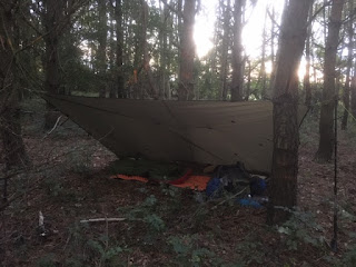
 I spent the night in a belt of mainly conifer trees between Godington and Poundon. The path goes through it, in theory. There was a clear way in but, this morning, I walked towards the path but overshot it and only located it by identifying the way I had come in last night. However, the path just disappeared in the middle of the trees. I was able to get to the other side by walking towards the daylight and there was a wide strip of grass the other side and then a hedge so I walked alongside the trees to the other end where I should have met the path coming out of the trees but path there was none. However, in a field corner there was a stile so I knew which way to go.

My trail guide book from 2002 said that the path through the trees was not clear and recommended going around the woodland. 

The path to Marsh Gibbon should have been easy. However, north of the village at about SP647246 I was on a clear path but there was a new fence ahead of me with no way through. I cut back towards the road and emerged at a gate at SP649246 where there was a notice saying that the path uphill from there was closed due to East West Rail works. This seems to be the proposed new line from Oxford to Cambridge. There was a lot of work going on and the path won't be open again till July 2023. Once at the road, I walked from there into the village.

After walking through fields the other side of Marsh Gibbon I followed a lane to a junction with the A41 at SP636200. There should have been a path across the road but I went back and forth and it just wasn't there so I walked along the nearby side road and took a path at SP636195 and rejoined my route a short distance into the field. It was quite wet underfoot due to the recent rain. I begged water at The Old Farm House and then made a navigational mistake a few yards away. Basically, DO NOT go straight ahead here into the large field immediately ahead. Instead, turn sharp left as you enter what is optimistically described as an orchard to a stile in the corner and into the adjacent field.

Ludgershall was nice with its wide grassy verges either side of the road. It came on to rain a bit as I made my way across fields to Piddington and the end, for me, of this part of the Seven Shires Way. To be continued but probably not until next year. About 151 miles remaining.

Monday 12 October 2020

Seven Shires Way Day 7 - 11 October - Hethe to Poundon

Colin sent me off with an excellent cooked breakfast. I made my way back to Tusmore Park Estate and went north to Juniper Hill, the hamlet where Flora Thompson, author of Lark Rise to Candleford, lived. I took a picture of her cottage from the lane.

On to Mixbury and Westbury, where I stopped for lunch. Just over the road were ornate painted boards mounted on a wall. I don't know what they mean. The Way then came south to Finmere, Barton Hartshorn and Chetwode. The church here was very old with an attached large house, Chetwode Priory, which didn't seem to be occupied.

I'm camped in a belt of woodland between Godington and Poundon. Fourteen miles today.

Saturday 10 October 2020

Seven Shires Way Day 6 - Kings Sutton to Hethe

Well, my pitch last night scores maximum points for seclusion, just feet from the towpath but only accessible off it by going about 30 yards through brush and coppice between the canal and river. I slept well despite the trains and traffic. The photo above is courtesy of the WhatThreeWords app.

I walked along the towpath to Twyford and Aynho. Not far after Aynho, I left the canal to cross it at Wharf Farm Bridge and followed a very quiet lane to Souldern, a lovely village. More road walking on a long straight road to Roundhill Farm although I stopped by a gateway sheltered from the wind and made coffee.

Not long after, I entered Tusmore Park, a large estate owned by a Syrian billionaire businessman, Wafik Saïd, who actually lives in Monaco. There are security cameras everywhere. I was about to take a photo of the house when someone appeared and asked me not to. A lady dog walker I met told me the owner is an arms dealer.

I diverted a little from my route to visit an old school friend, Colin, in Hethe and I'm camped in his garden. Had a great evening with him and Lyn.

Only about ten miles today.

Friday 9 October 2020

Seven Shires Way Day 5 - 9 October - Highfield Spinney to Kings Sutton

Away at 7am. Mainly field paths which took me through Wardington, Chacombe and Middleton Cheney, not far from home but I didn't really know them. The first two have many fine Hornton stone houses and cottages. Middleton Cheney has its nice parts but has been spoilt by modern housing developments. Still, it has a Co-op which was useful.

After Warkworth. I followed the route of the Jurassic Way towards the M40 which I heard long before I reached it, first crossing the railway by means of a bridge and then an underpass beneath the motorway. Not long after, I met the Oxford Canal where I stopped for lunch on the towpath. After lunch I had a leisurely walk beside the canal for about three miles. I only have ten miles to my destination tomorrow so stopped early. I found a possible pitch on the towpath itself by a former railway bridge but preferred to be out of sight although there have been very few people about. Anyway, only a few yards further on was a way into some scrubby woodland between the canal and the River Cherwell and my tarp is very well hidden. It's not quiet though - the railway is very close and there is constant traffic on the M40. Still, both should become less intrusive later on. Someone has camped here before although maybe not since 2013. I shall take the empty beer cans with me in the morning.

Seven Shires Way Day 4 - 8 October - Mollington to Highfield Spinney

Back walking the SSW again. I have about 66 miles to do and plan to reach Thame next Tuesday or Wednesday. Amanda dropped me off along a lane just outside Mollington by some agricultural buildings. The path went alongside them.

I followed field paths and then a road into Claydon, Oxfordshire's northernmost village, bordering Northamptonshire. Along a narrow lane a short way out of the village, I crossed over the Oxford Canal. A grassy area beside Claydon lock looked perfect for camping but it was only 5pm and I planned another hour walking. The larch plantation I'd identified in the map wasn't suitable but Highfield Spinney is fine. It was very noisy earlier with pigeon, crows and pheasant but it's quiet now although I just heard thudding hooves of maybe a deer.

Just three miles walked but I only set off at 3.45pm. After all the rain of the last few
days, it's now looking not quite so unsettled. I'm sure there will be some rain but it's not cold.

Monday 3 August 2020

Seven Shires Way Day 3 - 30 July - postponement

As I set off this morning across Farnborough Park, my shins immediately started feeling decidedly uncomfortable. Having suffered from shin splints before, I knew that I needed to rest my legs for a while and so I made my way into Mollington, phoning home on the way for Amanda to come and pick me up. I whiled away the time sitting in the churchyard which was as nice a churchyard as I could have wished.


Although I've done some day walking during lockdown, I haven't been doing as much on a daily basis and I haven't been attending the gym. Consequently, for me to expect my legs to carry me on two consecutive twenty mile days was asking a bit too much.

A day after returning home, I was hit by a sickness bug but am recovered now. Possibly due to water along the way although all water was filtered.

Anyway, I'll no doubt be getting out again soon.

Wednesday 29 July 2020

Seven Shires Way Day 2 - Tuesday 28 July Traitor’s Ford to Farnborough Park

Walking 6.15am to 6.30pm
Distance walked 20 miles
Distance left 191 miles

My Thermarest has sprung a leak, only a small one but I had to blow it up three times in the night.

It was a lovely morning as I made my way up Ditchedge Lane. The field edge where I overnighted last year is now rutted with vehicle use so I’m glad I stopped when I did last night. I met a friend who lives nearby walking his dogs and stopped for a chat.

Through Epwell and across to Upper Tysoe, a large village with a decent little supermarket. I refilled water from an allotment tap. Across fields and then quite a climb up to Edge Hill and through Ratley.

The view west from Edge Hill
At Shotteswell I went into the church. The organist came in to practice. John Profumo used to live in the village.

From there, I headed for the M40 pedestrian bridge. On the other side, the path was next to and parallel to the M40 for the best part of a mile, not pleasant as, apart from the noise, the path was overgrown often to shoulder height.

Mollington looked very nice but it didn’t detain me and I followed field paths northwards to Farnborough Park. I had hoped to get beyond Claydon but I’m suffering from possible shin splints which is a little painful. Perhaps twenty mile days is a bit ambitious. I’ve found some nice woodland to spend the night in and I’ll decide what to do in the morning. Having had shin splints before, the remedy is rest. The problem with stealth camping at this time of year is that I tend to walk until late and maybe that’s a bit too much.

Tuesday 28 July 2020

Seven Shires Way Day 1 - Monday 27 July. Cornwell to Traitor’s Ford

Walking 9.50am to 7.40pm
Distance walked 21 miles
Distance left 211 miles

The SSW is a 232 mile circular walk, more or less following the boundary of Oxfordshire. I joined it at Cornwell although the guide book starts it at the Four Shires Stone, about a mile east of Moreton-in-Marsh.

From Cornwell, I followed a single track road to cross the A436 towards Chastleton, the path crossing Chastleton Barrow, an ancient fort, although there’s nothing to see. Then down the lane past the church and NT Chastleton House. My navigation went rather haywire near Chastleton Glebe and when I met a road I managed to turn right instead of left.

The Four Shires Stone has a county name engraved on each side - Gloucestershire, Oxfordshire, Warwickshire and Worcestershire. This was originally where the four counties met but the Worcestershire boundary is now quite a distance away.

I had a lunch stop on a bench in a tiny, well cared for fences paddock  In it is the grave of a local farmer who died in 1994 aged 30. There is also another grave, possibly of his mother who died in 2015. A beautiful spot.

Field paths and a track took me to Barton-on-the-Heath. High deer fences protecting a deer farm. I took a photo of a magnificent antlered stag. He was sitting only a few yards away and looked at me disdainfully.


On to Little Rollright comprising a tiny church and a Manor House and associated buildings. I stopped to talk to a chap on the path who happened to own the manor. The Rollright Stones were nearby although I only saw the Whispering Knights before entering the beautiful Neolithic Echoes sculptured woodland.

Skirting Great Rollright, field paths to Ascott and then some quiet road walking. I had planned to camp along Ditchedge Lane, a long bridleway but it came on to rain heavily so I dived into woodland just before Traitor’s Ford to pitch for the night.


It rained on and off for much of the day but the forecast is better for the rest of the week.

Monday 16 March 2020

Update

The rapid onset and constantly changing coronavirus situation has convinced me to end my walk of the South West Coast Path. Apart from the fact that rail companies may start reducing services, thereby making my return home by train from Poole uncertain, I believe that my time can be better spent back home helping any initiatives within my community. I shall, therefore, be returning home in the next few days.

Sent from my iPhone

South West Coast Path Day 10 - 15 March 2020 Tintagel to Port Isaac

Walking 8.30am to 3.30pm
Distance walked today 9 miles
Total distance walked 130 miles
Distance remaining 476 miles

Heavy rain in the early hours although it was easing off as I packed up. I was only a minute from the coast path. I spoke to a local fellow walking his dog. He was younger than me. He said he'd never walked any of the coast path, citing a bad back and knee as his excuse.

I saw no-one else till Trebarwith Strand. Here, the public loos were permanently shut and the Strand Café was closed. I was looking forward to a coffee. It was a long pull up from here. A dog walker here told me there were just a couple of ups and downs and then an easy walk into Port Isaac - he was wrong. There proved to be five.

I caught sight of the village from afar as I came around to Port Isaac Bay. It never seemed to get any nearer. There were stretches of mud on the path. Here and on descents, I became aware that my boots weren't gripping enough and I was slipping a bit. They are by no means new but clearly aren't up to it. I'd hoped they would last a little longer but they don't feel safe.

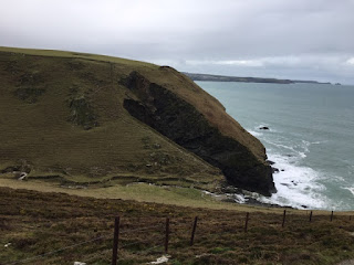
I think the combe at Lower Hendra was the most challenging. I timed my ascent at 9 minutes. If you zoom in on the second photo you will make out the path. A couple of areas were under water but my ageing boots didn't let water in. The weather is improving and the sea is changing to that lovely greenish blue. The sun came out for a while although at one point I saw rain approaching from across the water but that didn't last.

Eventually, I arrived in Port Isaac after a very long 9 miles. I bought a pasty and had just sat down to eat it when Amanda texted to say that she was quite nearby in the car. There was no way she should have tried to drive into the village so I stuffed my part eaten pasty into my backpack and began the long haul up Church Hill to meet her.

South West Coast Path Day 9 - 14 March 2020 Crackington Haven to Tintagel

Walking 7.20am to 4.30pm
Distance walked today 13 miles
Total distance walked 121 miles
Distance remaining 477 miles

Only a 10% chance of rain today but it rained just before I packed up and several times during the day.

Quite a bit of mud but some lovely cliff top walking. The long ascent of Rusey Cliff was punishing. I met a lady from New York who was walking from Penzance to Inverness. At one point there was a sign indicating four miles to Boscastle - it took three hours. When I eventually got there, I did a resupply at Spar and then eased a beautiful large pasty down my throat outside the bakery and then over the road to the Bridge Tea Rooms for a coffee before thinking I ought to be on my way.

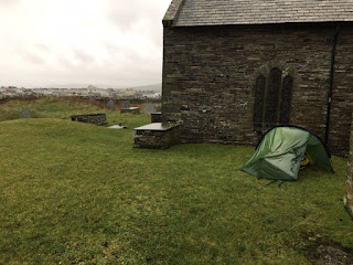
Above Bossiney Haven, I took the path to meet the road at Bossiney and walked into Tintagel which I don't recall visiting before. It didn't detain me and I made my way to the church. I chatted to a lovely lady preparing the church for tomorrow's service. She said I was welcome to camp in the very large churchyard which is now where I am.

Saturday 14 March 2020

South West Coast Path Day 8 - 13 March 2020 Hobby Drive, near Clovelly to Crackington Haven

Walking 6.20am to 5.00pm
Distance walked today 14 miles
Total distance walked 108 miles
Distance remaining 496 miles

When I walked this route in 2001, it was with my daughter, Philippa, then aged 18. In fact, we started from Lee Abbey (where she was at a summer camp) and so we didn't start from Minehead. I recall that we didn't walk the Taw estuary to Barnstaple and not did we estuary walk to Bideford either as we caught a ferry from Instow to Appledore. In addition, for as far as Boscastle, we only carried daypacks as we were met each evening and taken off to a campsite. Also, it was August and I don't remember any mud. Consequently, for me to reach St Ives by the end of next week is an impossibility.

I needed to reassess. My original intention was simply to make this walk a personal challenge. To raise money for Ucare was a last minute decision. I hope those who have kindly donated won't object if I change the plan a bit. Having made the decision last night, I got up extra early this morning (very loud owl nearby) and caught the 7.45 bus from Clovelly Visitor Centre into Bude, leapfrogging some 25 miles and getting me into Cornwall. A benefit is also that I've avoided the punishing stretch between Hartland Quay and Bude, about eight steep descents and ascents. I've done it before so I know what I've missed! Anyway, it's my walk so I decide what I'll do! To celebrate, I bought my first Cornish pasty to eat at lunchtime.

I stopped for a coffee at the café at Widemouth Bay and phoned home to announce the new plan. Amanda's commitments at home are falling by the wayside due to the Corona virus and so she's intending to revise her plan to come to St Ives at the end of next week. Instead, she's travelling to Newquay this Sunday, where she'll base herself for three nights and ferry me about as necessary. She will also arrive at St Ives on Thursday instead of Friday. This walk was originally unsupported but that won't now be the case for the next couple of weeks. I'll also get to sleep in a comfortable bed and won't be camping after tomorrow night and can walk with a daypack and hopefully cover more miles.

The new plan settled, I resumed walking. I had lunch (the pasty was good and won't be the last) on a bench before the descent to Millook. A couple came by and stopped to chat. They asked if I'd read The Salt Path. I replied that the book was the reason I was walking the SWCP now. So many people have read it.

I dropped down into another couple of steep combes. Then instead of another pointless climb and steep descent from Castle Point, I took the path to the tiny village of St Gennys, visiting the church and then rejoining the coast path a little further on. After that, there was a long descent to Crackington Haven. It was now around 5pm and rain was forecast imminently and into the evening. I found a grassy area close to where the coast path resumes and asked a person nearby whether she thought I might get away with camping there tonight. Better than that though she directed me to a very secluded spot which is where I now am. The day has ended rather nicely, occasional traffic noise and constant sound of the waves. It's been a strenuous day but exhilarating.

I'm asked sometimes about the food I eat. My evening meals for the last three nights have been: 1. Batchelors noodles (I discarded the chicken flavouring), a tin of sardines in tomato sauce and shavings of cheddar - a bit like a Mediterranean fish stew and very nice. 2. Chopped up pieces of cooked chicken in Uncle Ben's pilau rice. 3. Chopped up pieces of cooked chicken in Uncle Ben's egg fried rice. Not enough veg though.

Friday 13 March 2020

South West Coast Path Day 7 - 12 March 2020 Northam Burrows Country Park to Hobby Drive, near Clovelly

Walking 7.10am to 5.30pm
Distance walked today 14 miles
Total distance walked 94 miles
Distance remaining 536 miles

Although I'd pitched in a horseshoe patch of ground surrounded by bushes it was still a very blustery night. In spite of that, I managed to sleep well until 6.15. As I was packing up I caught sight of someone with a pack walking out of bushes a little distance away. Another wild camper perhaps.

I set off to continue along the park road to do a circuit of the park but ran into problems. An area was fenced off with danger notices. Going around the fenced area, I encountered floods with no way round in sight. Therefore, I retraced my steps past where I'd camped and set off across the flat land for about a mile to reach the park road on the other side.

Wednesday 11 March 2020

South West Coast Path Day 6 - 11 March 2020 Barnstaple to Northam Burrows Country Park

Walking 12.10pm to 6.10pm
Distance walked today 16 miles
Total distance walked 80 miles
Distance remaining 541 miles

For anyone interested, Phil's account of his SWCP walk is on Facebook - just search for Phil's Thru-hike of SWCP and Rest Month on Isles of Scilly. He hasn't got the impressive beard now.

After breakfast, we walked into Barnstaple. First stop was a phone repair shop where I left my phone for a new battery to be fitted. Then Mountain Warehouse for an inexpensive waterproof jacket. After a coffee at Costa, we collected the phone and went off to join the trail out of Barnstaple, now on the other side of the Taw estuary. It's a hard surface and there were dog walkers and cyclists. At Fremington, we stopped at the café on the trail and Phil then left to return home. It's good to have made a new friend and I hope we keep in touch. Many thanks Phil for your hospitality and good company.

Today's walking was mainly level and on good surfaces, with just a few muddy stretches towards the end - and it didn't rain, although it's raining as I write this.

I walked by industrial jetties and then sand dunes as I came into Instow. I then followed the former railway line alongside the River Torridge into Bideford. The town didn't detain me but it's reserved for a future visit. Crossing the river, the trail passed through Bideford alongside the other side. The path wound through some woodland. I stopped to chat with a lady who was sketching the ruined hulks perched on the mudflats. I then skirted Appledore Shipyard before entering the delightful village of Appledore, which brought to mind the narrow streets of St Ives.

South West Coast Path Day 5 - 10 March 2020 Woolacombe to Barnstaple

Walking 7.30am to 5.30pm
Distance walked today 16 miles
Total distance walked 64 miles
Distance remaining 558 miles

Although I was sheltered behind a tree, it was still a very blustery night with some more rain. As I was getting ready for the day inside the tent there was a yapping of a small dog outside but, apart from that, all was peaceful. I put on all the wet clothes from yesterday, not pleasant but they soon warmed up. 

I didn’t go back into Woolacombe but had a brisk road walk towards Croyde. It rained and was very windy but I was sheltered from the wind much of the way by high walls and hedges. At the village of Georgeham I found the church open and, not only that, there was an available loo! Perfect. There was also a small village shop, a limited stock but I bought a couple of flapjack bars for two breakfasts and stuff for my meal tonight. On then to Croyde where I rejoined the coast path. 
I passed above the expanse of Saunton Sands, a little misty and one rider on a horse and a few other people. 


Then the path went through Saunton Golf Course which was almost deserted. Just past the golf course I encountered two stretches where the path was completely under water with no way to get around it. I’d packed sandals so put these on and waded through with boots tied together and around my neck. A bit of a palaver and I had to gets boots off and sandals on as I didn’t realise there were two waterlogged stretches. At its deepest, it came half way up to my knees so boots weren’t an option. 


On reaching Braunton Burrows car park I could see that my intended route was under water. As I had no idea of the state of the path around Horsey Island, I opted to avoid it and, instead, road walked to Velator, just outside Braunton. I’d looked online and seen that a campsite I’d been considering (Chivenor Caravan Park) is now permanently. I therefore phoned a friend, Phil, who I’d previously contacted via Facebook, as he did the SWCP in 2018 and suggested I get in touch when near to Barnstaple. I did just that which resulted in an offer of overnight accommodation. I just had getting on for six miles to walk along a hard surfaced trail, a former railway line alongside the tidal River Taw estuary. As it happens, there would have been many opportunities to wild camp on grass beside the trail and two grassed areas set back. There aren’t really any camp sites around Barnstaple. 

I made my way to Phil’s house and we’ve spent a great evening chatting about the coast path and other topics. He’s planning to walk with me tomorrow morning. 

If you look closely, you’ll see that the mileages above don’t quite tally. This is because I’ve happened to cut a couple of corners and not necessarily by choice. I think the miles remaining figure is correct.

Monday 9 March 2020

South West Coast Path Day 4 - 9 March 2020 Little Hangman to Woolacombe

Walking 7.20am to 5.40pm
Distance walked today 15 miles (plus a bit faffing about finding a campsite)
Total distance walked 48 miles
Distance remaining 582 miles

A muddy walk down into Combe Martin. I didn't stop here. The route passed through Watermouth camp site, closed for the winter season, but a lovely grassed area and their water tap was working. Shortly after I chatted to Andy, out walking his Old English Sheepdog, Dougie. He told me I'd just passed the home of Damien Hirst's mother. He knew all about the geology in the region and that there used to be a silver mine in Combe Martin.

At Hele was a challenging zigzag path. On reaching Ilfracombe, I fell into Adele's, a lovely cafe and ordered their standard breakfast - it was lovely.

Sunday 8 March 2020

South West Coast Path Day 3 - 8 March 2020 Countisbury to Little Hangman

Walking 7.10am to 5.30pm
Distance walked today 14 miles
Total distance walked 33 miles
Distance remaining 597 miles

A very blustery night but I slept very well. The little quarry where I was pitched was flat but after prolonged rain the ground gets waterlogged. My patch was the best but after much rain in the night even that was squelchy this morning. It wasn't raining by the time I got up.

I made my way down to Lynmouth. Only dog walkers about as it's out of season. Although not on the route, I diverted to Lynton for a bit of food shopping and went from there to the Valley of the Rocks and then past Lee Abbey. The rain forecast for midday started early at 10am. I took the longer off road route by Crock Point but in retrospect the road alternative would have been better, avoiding muddy field paths followed by a strenuous uphill through woodland to rejoin the road. I met two Lee Abbey estate workers who had found an apparently abandoned tent and contents but no person in it. It had been there a couple of days.

The path to Heddon's Mouth was lovely. Along this stretch I stopped to talk to a couple with a dog. They'd walked the entire coast path before and plan to do it again. Small world - they were from Evesham and are friendly with Vicky at the Tea Set back home.

The climb up Heddon's Mouth Cleave was steep. This was midday when, supposed, there was 90% chance of heavy rain. In fact, there was a cloudless sky and the sun was out. I was flagging so had a lunch stop part way up. The path looking out over Elwill Bay was stunning with great views ahead and back the way I'd come but it was very windy.

Later, there was a very muddy descent to Sherrycombe followed by a steep and long slog up to the cairn of Great Hangman, the highest point on the SWCP. I'd planned to camp around Little Hangman if I could find a reasonable pitch. I'm in the lee of a wall looking out to sea just below Little Hangman. The wind ranges from quite still to quite blustery. I should have a reasonable night after my supper of cheesy mash and tinned tuna.

South West Coast Path Day 2 - 7 March 2020 North Hill to Countisbury

Walking 5.50am to 5.00pm
Distance walked today 16 miles
Total distance walked 19 miles
Distance remaining 611 miles

I got up when I woke up, thinking it would be getting light by the time I was away. In fact, I walked the first half hour in the dark. Still, the path was easy to follow.

Around the foot of Bossington Hill the dog walkers were out. It was very muddy in parts around the marshes skirting Porlock. A week ago I'd seen a photo on Facebook of the flooding on one side of a footbridge. I think it had subsided a little as I was able to make my way around the edge.

The path entered woodland past Porlock Weir and wound its way up and down to Culbone where there is the smallest church in the country in regular use. Here and at other places along the way I filled my water bottles from streams and waterfalls, putting half a chlorine tablet in each.

Today has been hard work with numerous ascents. Not far from Countisbury a lady was clearing away an honesty shop by the trail. Just in time I relieved her of a banana and a nutty bar. I'm pitched in a small former quarry not far from Countisbury church. It's very blustery.

Sent from my iPhone

Saturday 7 March 2020

South West Coast Path Day 1 - 6 March 2020 Minehead to North Hill

Walking 3.30pm to 5.30pm
Distance walked today 3 miles
Total distance walked 3 miles
Distance remaining 627 miles

All the travelling went well, even the five minute change of trains at Reading which I wasn’t expecting. On reaching Taunton station, the bus stop I wanted was just across the road after walking beneath a railway bridge. I had a half hour wait for the no. 28 bus and passed the time chatting to two ladies, Hattie and (?) Helen (she’ll correct my poor memory, I hope) on their way to a watercolour weekend at Minehead. 

On arriving, I went in search of a barber to have a severe haircut, so I can simply forget about my hair for the duration. Also the Co-op for inexpensive bottled water to get me started. That done, I headed for the sea front and the SWCP sculpture that marks the official starting point. A couple sitting on the sea wall kindly took my picture for the record. 

A cloudy and breezy walk to start with, past a small harbour and then a path above a stony beach until I reached some steps which took me on to a steep zig zag muddy path through woodland, climbing until a level track was reached on the edge of bracken covered moorland. The remains of Burgundy Chapel were below, a site to visit another time maybe.
Around here, there is a choice to be made. Take the right fork to follow the Rugged Path or left for the less rugged path. I’d walked the Rugged one before so I took the other. 

I passed a couple of dog walkers, walking in the direction of Bossington. Finding a perfect small patch of grass just a few feet from the path, it was a little early to pitch so I made some tea. When light started to fade and judging it unlikely that I would be disturbed, I put the tent up. A short day but I’m off to a good start. Before it got dark, I was able to look across the Bristol Channel to see the lights of South Wales. A home made Bhuna curry went down quite well. Now and then I hear the comforting sound of an owl. 

Wednesday 26 February 2020

South West Coast Path fundraising

Obviously, tackling the SWCP in one hit is a considerable undertaking. It seemed to me that it would be worth using it as a charity fundraiser and not to do so would be a waste. Ucare Oxford is a charity close, not only to my heart but, also, to my one remaining kidney. I walked for Ucare in 2018, raising something over £2,000 on the Great English Walk from Chepstow to Berwick-upon-Tweed. Should you wish to read my account of that walk, then the blog entries start here. I have set up a Just Giving page here. If you enjoy what you read then do consider making a donation, however small.

With just over a week to go, preparation is in full swing. A room in the house is strewn with gear, being narrowed down with what I will actually take with a view to keeping my pack as light as possible. An advantage of the route is that I shouldn't need to carry more than a couple of days worth of food as there are regular places to resupply along the way.

Over the last few weeks, there have been many changes of mind over which bits of kit to take or not take. For example, I was originally intending to wear non-waterproof trail shoes for guaranteed blister free walking. However, a walk last weekend through incredible mud and flooded paths persuaded me to wear boots with strategically placed duct tape on my feet. My left foot generally suffers worst in boots as it is half a size smaller than my right foot.


Sunday 26 January 2020

Plans for 2020

My hiking plans for the next few months have been thrown into disarray. I had been intending to walk the Hardy Way in February, for which I bought the guide book when in Dorset last year. Then, in April, I was planning to go back to Sweden to walk more of Sörmlandsleden. However, having recently finished reading The Salt Path, I was inspired to walk the South West Coast Path, all 630 miles of it from Minehead to Poole. I've done most of it before over several years but never as a continuous route so this is the plan. I take to train down to Taunton on 6 March and then bus to Minehead.

The guidebook (by my good friend Paddy Dillon) and maps have been bought and I have something challenging to look forward to.

A January night out

Having 24 hours available, I set out from home in the morning with a tent, a bit of food and my new sleeping mat, a Christmas present. This is a Nemo Switchback. With a longish hike coming up, I wanted to try an alternative to an inflating sleeping pad as these are prone to puncturing.

There was a lot of mud and water underfoot and, as I was using a tent, hadn't brought hiking poles. This was a mistake and, in a cleared coppice just outside Little Compton, I picked up a stripped branch which proved to be very useful when navigating muddy stretches as it helped me keep my balance.

I had identified a likely location for a wild camp about half a mile north of Long Compton, a wood with a public footpath running through it. I didn't expect anyone to be passing through as it is some way out of the village and this proved to be the case (as far as I know). My pitch was maybe fifty yards from the path on the edge of the trees with a view across a field, part of Weston Park. I was tucked away, well out of sight. My first little problem became apparent as I unpacked my tent when I realised I had brought the pole for the tent I intended to bring but had brought the wrong tent! Both are stored in green bags.

Anyway, with very little ingenuity I strung the outer between two trees to make a tarp and used my stick as a support at the front, not that this was really needed. The inner I rolled out on the ground to lay my sleeping mat on. Perfect.


I spent a peaceful evening and night. The pheasants were raucous for a while and I heard a distant muntjac in the early hours. In the morning, I broke one of my cardinal rules for wild camping, namely pitch late and leave early. I woke at 7.10, made tea and was about to make some porridge when I heard a vehicle approaching along the side of the field and it stopped right next to where I was pitched. Apparently, on arrival or maybe afterwards when moving around, I'd triggered a security camera so my exact location was known. It wasn't a great problem, however. The farm or park employee gave me a warning about shooting that goes on around here. I said I'd be gone in twenty minutes and he departed. I'm not sure that shooting would actually have taken place so near to a footpath but why were there cameras? Maybe to protect breeding pheasants nearby as the night before I'd spotted the same vehicle on the far side of the field going round to other woodland not far away and I'd heard sounds of possibly birds welcoming the arrival of a food supply.

Anyway, I packed up and went on my way, really annoyed with myself for not striking camp immediately on waking (and waking earlier). Had I done so, I'd have been well away before the visitation at around 8am.

There was plenty more mud on the remainder of my walk but it was a good outing. The sleeping mat proved to be a success. Reviews to these are mixed from a comfort point of view as they aren't quite as comfortable as an inflating mat but I was prepared to sacrifice a little comfort to have a mat which wouldn't let me down. In use, it was comfortable on the leafy floor of a wood except under my shoulder (I'm generally a side sleeper). However, I put the pad from my backpack under my shoulder and this was fine.

So, my wild camp location was good but, if anyone wants to avoid the place and possibly being discovered, it's at SP290343.