Friday 26 April 2019

Sörmlandsleden Day 16 - Middle of Stage 44 to Skavsta airport

Walking 8.10am to 3.15pm
Distance walked 14km

At the end of Stage 44, I diverted for a short distance on Stage 44:1 to where I knew from last there is a water tap. There are also two shelters and picnic tables. As I was in no hurry, I stopped here for breakfast and read for something over an hour in the sunshine. Another lovely day.

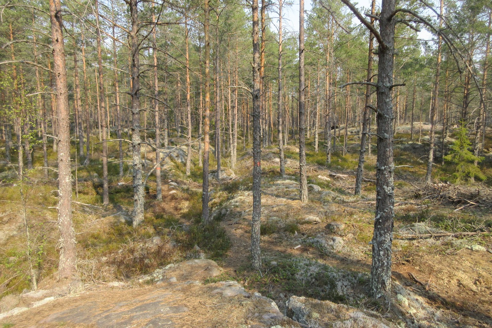
I then rejoined Stage 44 to meet the road into Nyköping and walked along a cycle path. Moving on to Stage 44:2, I bought food for tomorrow's journey at a big supermarket on my route. I had cash on me from a previous visit to Sweden but it seems they only take cards. Managed to pass by two burger restaurants without stopping.

Reaching Oppeby, I cut through a housing estate to join Stage 46:1 by the river and this brought me to the airport.


Having time, I passed by a tiny F11 fighter plane museum (open weekends only), with an F11 stationed outside, and then went to inspect the carved wooden Mother Earth sculpture facing the runway.


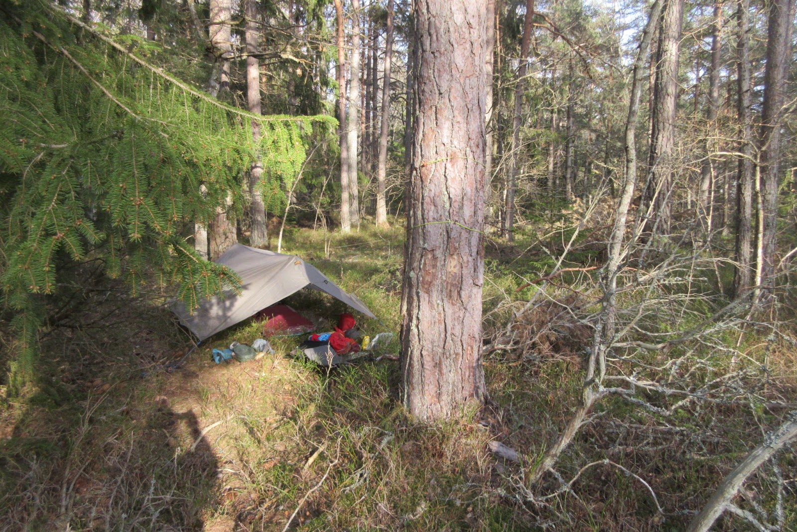
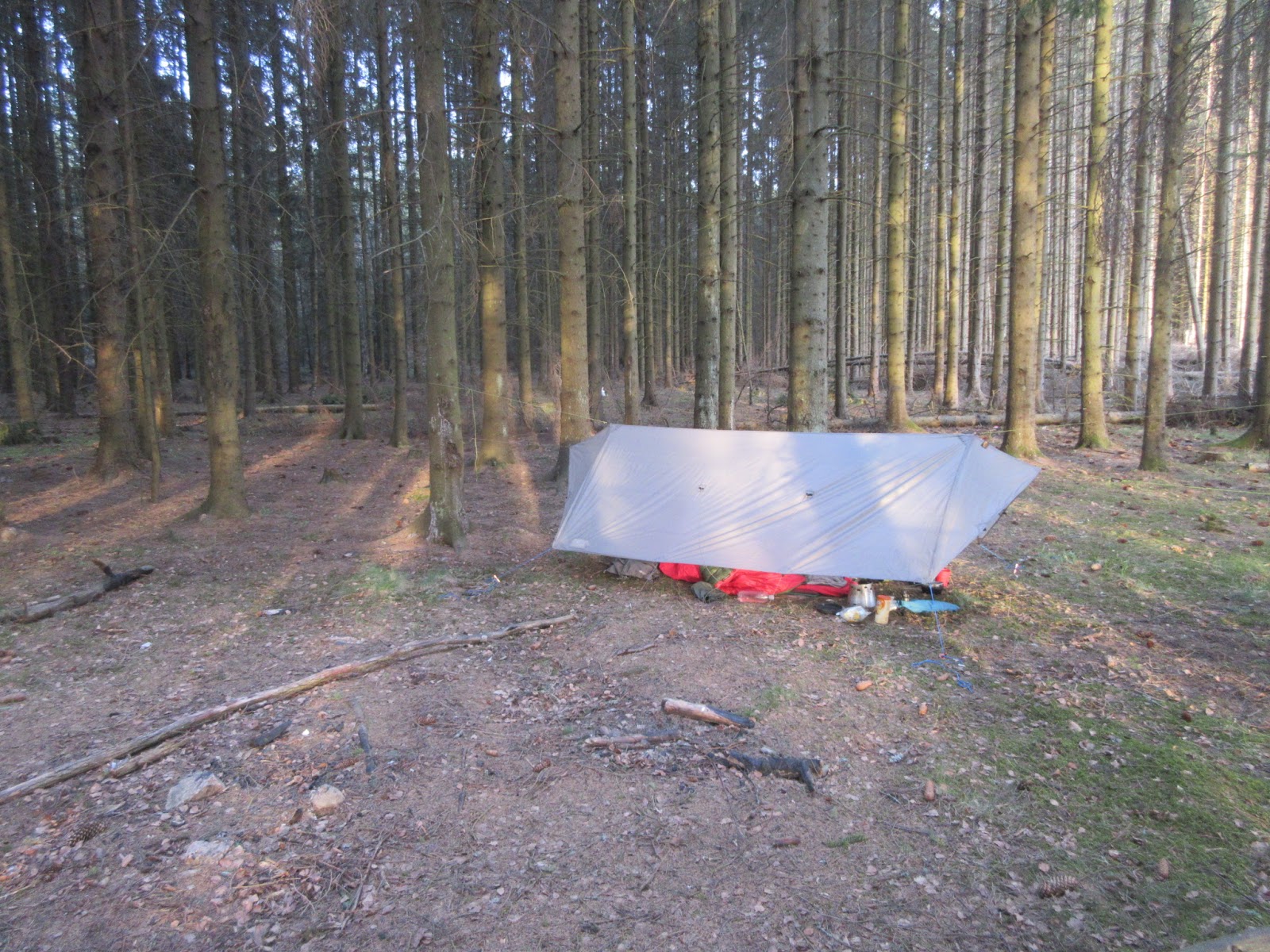
Last task was to find my pitch for the night. I had identified a belt of woodland not far away but, in fact, have found a spot only ten minutes from the terminal. I hope it's not too noisy. Shortly after I'd pitched, a plane burst into life and very noisily warmed its engines up for twenty minutes only about two hundred yards away. There is other aircraft noise now and again and a bit of road traffic but I expect (hope) that it will quieten down later.


I've set my alarm for 3.45am. I have to be at the terminal two hours before my 6.30am flight home.

Sent from my iPhone

Thursday 25 April 2019

Sörmlandsleden Day 15 - Överdammen to middle of Stage 44


Walking 8.10am to 2.50pm
Distance walked 17.5km

The day started overcast but the sun broke through later. Although I've been wearing shorts for the past week, I have trousers for travelling home on Saturday and they were a bit grubby as I'd been wearing them for walking the first few days when the weather was colder. I dunked them in the lake to get some of the dirt out. I should have thought to have done it last evening and then they'd have largely dried out overnight. Anyway, I wrung most of the water out and draped them around my pack and they dried during the day. They are better than they were.

I suddenly found myself in the middle of a silver birch plantation. My favourite tree.


Completing the rest of Stage 36:2, I went on to 36:3. The route notes said the trail went over a "mountain", Jätterberget, all of 72m above sea level - little more than a hill.

The remains of a WW2 air surveillance station on  Jätterberget


Now and again over here, I've come across large ant hills made out of pine needles and absolutely teeming with ants. Swedish ants are about four times the size of those in the UK. They don't have wings and I don't know if they sting. Anyway, the path up to Jätterberget was alive with ants and I found them crawling up my legs!

Not a lot more to say about today. Stage 36:3 completed my circuit which I started on Day 10 by meeting with Stage 44 which leads back to Nyköping. I picked up water at the same excellent spring and pitched early at the same spot as at the end of Day 10.


Sent from my iPhone

Sörmlandsleden Day 14 - Vibberholmen to Överdammen


Walking 7.50am to 3.50pm
Distance walked 17.5km

A lovely sunset over the water as darkness fell last night. 


This morning, a ship went by, possibly bound for 
Nyköping. 


Promising to be another fine day, I walked the trail, often down to the water's edge. It then went inland and passed by the site of a Kolerakyrkogård, a cholera burial ground, dating back to the 19th century. There's nothing there, just part of the woodland now. 


Reaching Lake Navsjön after 6.5km, I came across a peculiar structure called a Kolarkoja. This was a charcoal hut, occupied at one time by charcoal burners as the procedure took some time and meant the men didn't have to return home each night. 


I stopped at a shelter by the lake and took the opportunity to rinse out some items of clothing to freshen them a bit and replenished my water from the lake. Dotted around this end of the large lake were fishermen. One was descaling a large salmon by the water side. 


Stage 36 ended here and I then went on to 36:1, a good, clear, level path for most of the way. 


I stopped part way to fill my small bottle at a spring, one of those with a wooden cover. The stream next to it was a vile reddish brown colour but the spring water was surprisingly clear and uncoloured. 


At Gälkhyttan I went on to Stage 36:2 and, after about 2km, reached my halt for the night. There's a shelter and toilet on a finger of land jutting out into the lake. I've pitched on the westward side as it is much less windy and faced the afternoon sun. 


Just reading


The shelter guest book shows many visitors this year but very few spending the night although two Germans overnighted here only last night. Before that, the last overnighter seemed to be on 1 March. 


Sent from my iPhone

Tuesday 23 April 2019

Sörmlandsleden Day 13 - Viggudden shelter to Vibberholmen

Walking 8am to 4.50pm
Distance walked 18km

I left Grigory (I think that's how he anglicises the spelling) for him to walk about 9km north to Buskhyttan to catch a bus to Nyköping and then to the airport for his flight home to Poland. It was nice to have some company.


I walked the remaining 3km of Stage 39 along the coast to Västra Kovik, an up and down path over and between rocks. Then on to Stage 38. It was quite a climb up to Gullängsberget but great views across the Baltic. There is a Viking grave here, basically a massive mound of rocks. I had breakfast here.

Lunch overlooking the Baltic

At Uttervik, the route notes directed me to a water tap at the village's water treatment plant, just 200m off the path. Stage 38 ended at Lilla Uttervik and went on to 37 which took me through Sjoskogen nature reserve. Quite lovely. I then headed for the large village of Nävekvarn and its small supermarket to do what should be my final resupply.

On the edge of the village is a causeway to a tiny island on which there is a shelter. Unfortunately, it was too early to think of stopping for the night.


I walked on along the mainly rocky coast for about 3km until I found the perfect spot. There are wooden benches and barbecue facilities. Just feet away from are rocks which lead down to the sea. It doesn't get much better.

There is a guest book to sign which I did. Many others have also signed. Most are local and from other parts of Sweden but quite a few from other countries. Germany is well represented. There is a column to check for having overnighted here but not many have, although someone from Germany slept here on 21 April. I can hear a deer barking not far away.


Monday 22 April 2019

Sörmlandsleden Day 12 - Simonberget to Viggudden shelter


Walking 8am to 3.50pm
Distance walked 13km

With only around 16km to cover today (and for the next few days), I was in no rush. The morning started overcast but the sun fought its way through after a while although a bit on the chilly side.

I stopped to make tea at the wind shelter in a glorious location on Lake Mellsjön. Here I met Grzegory from Poland, over here for just three days, sleeping in the shelters along the way. He'd had a somewhat cold night as, in the rushed drive to the airport to catch his plane, he had managed to leave his sleeping bag in the car. He used an emergency space blanket by was cold.


I replenished water from the lake and spent well over an hour at the shelter after Grzegory had moved on, drinking tea, reading and even took the time to heat some water and had a shave.

A long walkway

Moving on, the walking was quite easy and really nice. My lunch stop was exactly at the end of Stage 40. Just yards away was a small meadow leading down to the water's edge of Lake Långsjön. The sun was shining. It doesn't get more perfect than that.


The trail reached the coast of the Baltic at the tiny former fishing village of Albåck, now nothing more than a few scattered cottages. The sea was a glorious blue. A couple of men were out on a drifting boat, fishing. The path then followed the coast line more or less with still more ups and downs over rocky parts.

First glimpse of the Baltic

Eventually, I reached the Viggudden shelter. Grzegory was already there and I pitched my tarp nearby. I offered my bivy bag to him which was accepted without demur.

The evening has passed pleasantly with chat and Grzegory got a good fire going. I gave him the idea of heating up some sea water to put in his metal Sigg bottle to keep his feet warm.


Sunday 21 April 2019

Sörmlandsleden Day 11 - Middle of Stage 44 to Simonberget

Walking 8.20am to 5.15pm
Distance walked 22km

I refilled water this morning from a spring. Not one, like most others, from a pipe but an inverted concrete pipe, about two feet in diameter, set in the ground with a wooden cover. The water level was quite high and the water was clear and clean.


Ant hill
 A mix of terrain, forest and farmland, following tracks and farm roads. Absolutely no-one else on the trail today.


Warm again but not quite as warm as the last couple of days and a cool breeze now and again this afternoon.

At Koppartorp is the Tunaberg museum of local history, comprising a number of small wooden buildings from various periods and also the only wooden church in Sörmland. The trail passes through the museum. My route notes indicate a water tap here but as the museum is closed the tap wasn't on. The summer season in Sweden starts late and finishes around the end of August I think.


Anyway, I had just enough water for tonight. A short distance out of Koppartorp, the trail approached Simonberget, a vast stone mass maybe 100 feet high. There was an optional path over the top. I took the path around the foot and it was as well I did. Scouting for a pitch for the night, I found just the place which I would have missed had I gone over the top. There is constant birdsong.

Simonberget

Saturday 20 April 2019

Sörmlandsleden Day 10 - Bergtorp to middle of Stage 44

Walking 6.30am to 5.20pm
Distance walked 22km

Was woken up early by birdsong so thought might just as well get going. It was a lovely morning but quite cold. 2km took me to the end of Stage 47 and then on to Stage 46. Even through felled areas, the path was generally easy to follow and trees with waymarks on had been left to just above the waymark.


After 6km, I reached the shelter overlooking Lake Hovrasjön and enjoyed a leisurely second breakfast - made up my last pack of Quaker porridge followed by tea. The lake is under the flight path to Skavsta airport. A couple of Ryanair planes came over to land.


The trail then made its way down to the rural suburb of Oppeby, crossed over the Nyköping River and, starting Stage 45, basically followed the river to the centre of the town of Nyköping. Parts of it looked quite attractive, especially in the sunshine; lots of people around.


Lunch stop
Stage 58 ended, conveniently, at the car park of a large Co-op where I was able to resupply for the next three days. Annoyingly, they had no large bottles of still mineral water for my requirements tonight. I bought two small ones which might just see me through. 

Now starts the second part of this adventure. The Sörmlandsleden website, under the Fly and Hike tab, describes a 94km Southern Route, a circuit which will include what should be some nice walking on the Baltic coast. I shall walk the circuit clockwise. 

As luck would have it, a couple of km along Stage 44, I was able to divert a short distance on Stage 44:1 where my notes (and the map) told me there was a shelter and a water pump. In fact, there were two shelters together and a water tap so problem solved. 

Retracing my steps, I'm now about one km into the forest, having found a nice pitch well away from the path. I shall be coming back this way next Thursday so may stop here again. 


Spot the tarp!
Sent from my iPhone

Friday 19 April 2019

Sörmlandsleden Day 9 - Middle of Stage 50 to Bergtorp (middle Stage 47)

Walking 7am to 5.15pm
Distance walked 26km

Another glorious morning and off to an early start. A fair amount of road walking today, though, but there is very little traffic. Maybe because it's Good Friday.

After 3km, I reached the church at Bälinge but it was shut. Still quite early. A concert was scheduled for later in the day. I made use of a water tap in the churchyard.

Bälinge church

At Tystberga, a very small town, I was surprised to find the Co-op open. I bought a pastry and what seems to be a Swedish product I've had before - risgröt - a sort of ready to eat rice pudding in a clear plastic tube sealed at both ends - 500g of it!

The trail ran close by the noisy and busy E4 road for a while before passing beneath it. My lunch stop was at the shelter by Lake Masugnsjön. I attacked the risgröt by piercing one end and squeezing it into my mouth - yum. Plenty left.


The lakes in Sweden - and there are hundreds, if not thousands, of them - are just beautiful, especially when the sun is shining. Many are only accessible on foot which means that they are totally unspoilt.

Traditional cottages

The church at Svärta was also locked, surprisingly. My notes indicated that there is a water tap close to the church, available in summer. Obviously, summer doesn't start by Easter. Anyway, the nearby church toilet was open and took advantage of the wash basin and gave my face and hands their first proper wash in a week.

Svärta church

Today, I've walked the rest of Stage 50 and 49, 48 and half of 47. I should reach Nyköping tomorrow and start the second part of this adventure. On sormlandsleden.se it's the Southern route 94km. Should be lovely and it includes some coastal walking.


Sent from my iPhone