Sunday 16 April 2023

Seven Shires Way - Goring on Thames to Moreton-in-Marsh - 21 March 2023

With a few days to spare and having to withdraw from the TGO Challenge in May, I decided to walk a further stretch of the Seven Shires Way in late March. I finished the last part in October 2020 not far from Thame. To resume from there isn't that easy using public transport and, if I walked for a few days, would involve walking alongside the Thames through Reading and I was quite happy to avoid this. Therefore, I got the train to Goring & Streatley with 85 miles or so to walk over five days.

On leaving the train, I bought a few things at the nearby Tesco and then went in search of the SSW. The first stretch follows the course of the Thames Path National Trail and then leaving it at Moulsford. A short road walk led me to a restricted byway alongside Moulsford Downs and then to the Ridgeway National Trail which I followed for several miles. I had reckoned on camping at Scutchamer Knob, a belt of trees shown on the map. There was a car park there with a couple of vehicles parked but it was fine. I obviously didn't take any photos this first day. It rained on and off.

Next morning I continued along the Ridgeway for a couple of miles and then taking a track to the left named on the map as Old Street. Reaching the village of Farnborough, I made use of a water tap I spied from the road at Upper Farm. The paths and tracks I walked were all easy and totally deserted with a feeling of remoteness. 

An interesting field and hedge formation

Through Fawley and into real horse country along straight tracks and a long stretch of road beside Eastmanton Down. Past Sevenbarrows House, a large equestrian place, I came across a large belt of woodland. I was looking for a camping spot but it was well fenced in so I continued walking. At SU306839 I saw a youngish plantation not marked on the map and only a hundred yards away. Perfect.


Crossing the B4000, I diverted from the SSW, taking the single track road to the south of Ashdown House (NT) and rejoining it at Swinley Down. I met the Ridgeway again at SU263865 where there was a water tap and, a short distance away, saw someone had set up home. A bit unsightly.


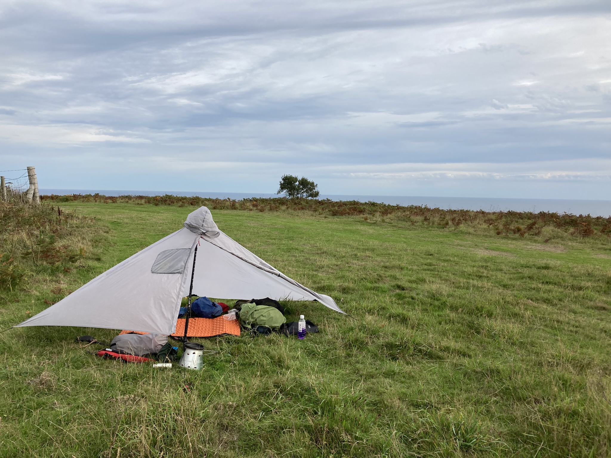
I left the Ridgeway at SU248823 and headed for a delightful grassy path through a dry valley


leading into a wide field of sheep.


After passing through Bishopstone, a muddy track brought me to a community woodland at SU250842 where I stopped for lunch. Much too early for an overnight. After Bourton, a claggy field walk brought me to the A420, south west of Shrivenham, a busy road with a long layby covered in litter. Escaping this, a wide track took me to Nightingale Wood, a large area of woodland where I could easily have camped but it was still too early so on I went. A couple of miles past Sevenhampton, walking along a lane I saw a gap in a hedge and this opened into a belt of young trees (SU219914) where I was able to hide myself away.

Next morning, I headed for Coleshill where my route took me northwards across a few fields and then a longish road walk where I turned onto a farm road at Snowswick Cottages leading to Broadleaze Farm. At Buscot (NT) I found a village tap that actually worked and replenished my water. Here it came on to rain quite steadily.

From here I went on to rejoin the Thames Path and followed this to Kelmscott. William Morris is buried in the churchyard.

Kelmscott church


Crossing the A361 just past Little Faringdon, I stopped for lunch in woodland not far from the road. No-one around. Walking on, I spent a little time exploring the adjacent villages of Eastleach Martin and Eastleach Turville - their churches are no more than two hundred yards apart. Leaving the road at SP208056, I went into a very muddy field and was followed by a hundred or so young cows for quite a distance. I eventually reached a stile so was able to escape them. Walking on in the rain and looking for somewhere discreet for the night, I came across a perfect woodland at SP198076.

Coming into Holwell, a house was being renovated and I went in and made use of a water tap. I was now on familiar ground on the D'Arcy Dalton Way, passing through Westwell, Little Barrington and Great Barrington. Here I stopped in the rain to talk with a Cotswolds warden. I found a useful water tap at Great Barrington (SP210138).


Rain came on with a vengeance but I found a reasonably sheltered spot for lunch at Miletree Clump. The muddiest length of path was at SP231165, a steep uphill that had been churned up by 4WDs. It was a struggle. The path then went alongside the former Little Rissington airfield and then into Fifiled. Whenever I pass through here, I check an unobtrusive water tap just opposite the gate into the church. The tap still works.

Fifield water tap

From Fifield, leaving the SSW and continuing on the D'Arcy Dalton Way, a very muddy path led to Foxholes Nature Reserve. I walked for half an hour through the deserted woodland to a spot where I've camped a couple of times before in Bould Wood, finding somewhere free of young bluebells.

I was away early next morning on familiar paths. I was treated to a rainbow over Bledington. 


Through Kingham and then a long bridleway which was flooded in places. There wasn't always sufficient grass verge. Here's a stretch where I had to wade very carefully to avoid the water filling my boots.


I was home by about 10.30am. A really good few days.

Tuesday 20 September 2022

South West Coast Path Day 15 - 17 September 2022

The final day. Leaving the site at Maker Heights, I followed a path out, south east, to rejoin the SWCP at SX440511. I walked for 1.5 hours and arrived at Cremyll ferry just as a boat was coming in. In Plymouth, I walked through the city, stopping in a McDonalds for breakfast and coffee. I then whiled away the morning, making my way to the station. I had a direct train to Cheltenham. There, I found that my train to Worcester had been cancelled. The next train was going to be twenty minutes late which meant that I would miss my next connection. I eventually got home, not allowing myself to get stressed which would have spoilt the holiday feeling.

About three miles walked to ferry. St Ives to Plymouth - 186 miles.

Friday 16 September 2022

South West Coast Path Day 14 - 16 September 2022

A late start - 8.45am. Bay View Farm is a good site. On the site owner, Liz's, recommendation I road walked to Seaton and Downderry. It avoided what she thought were pointless ups and downs parallel with the road. The road was single track in places and very quiet.

Some way beyond Downderry I stopped on the cliff top path and pitched the tarp to dry out. Shortly after continuing Tony came along, having overnighted in Looe. We walked together the next few miles. We parted company at the car park above Tregantle Fort where I stopped for a lunch break and made arrangements for travel home tomorrow.

Chalets at Freathy

Cawsand

I covered the last few miles to Rame Head and then through Cawsand and Kingsand in good time and got directions to the campsite at Maker Heights. Another good site with views across Plymouth Sound. It'll be a couple of miles in the morning to the Cremyll ferry into Plymouth.

Rame Head

Sixteen miles walked.

Thursday 15 September 2022

South West Coast Path Day 13 - 15 September 2022

Away really early, I walked back down the hill into Polruan to find the coast path. It was only just getting light so stopped to make an early coffee in front of the lookout station.

Polruan lookout station

There were some severe ups and downs through the day but I took a couple of leisurely breaks.

Near West Coombe

Polperro

Polperro was buzzing. I bought a large pasty to eat cold this evening. The stretch between Polperro and Looe was challenging but the walk into Looe was level. The climb out was steep in parts.


I'm camped at Bay View Farm, a good site with decent facilities. Quite a tough day but good weather. Fourteen miles walked.

Earlier today, I posted on the Polruan Holidays Facebook page about my experience yesterday. They apologised. Seems their mobile phone website had mistakenly not been updated. Still, they've obviously put their prices up significantly part way through the season.

South West Coast Path Day 12 - 14 September 2022

Another early start. The rain was continuous from mid-afternoon yesterday to 6.45 this morning. I packed up and the rain stopped just a few minutes before I left my pitch to regain the coast path, only ten minutes away.

At Pentewan I visited the Co-op at 8am and bought a restorative coffee and bacon and cheese turnover. The Co-op is easy to miss. Its rear gate is just before the bridge and directly on the path.

Approaching Charlestown (from the west), there is a major path diversion. It's not signposted. A couple had walked a quarter mile only to find the path completely blocked and had to walk back. I met them as they were about to start on the diverted route and we walked the mile or so into Charlestown. They then went to a cafe and I walked on.

Charlestown


Past Carlyon Bay I stopped for lunch. Another lightweight backpacker, John, stopped to chat. I caught up with him later and we walked together from Polmear to Polkerris, he to take a break and go another route. Shortly after, I met with Tony who I'd come across a couple of times this week. We walked to Fowey. At Gribbin Head, I'd considered camping but it was too windy.

Tony headed for his accommodation in Fowey and I went down to the quay where the Polruan ferry was waiting. On board was Sheila, just two days into a cycle ride from Lands End to John o'Groats. At Polruan, I helped push her panniered bike up the long incline out of the village to the Polruan Holiday Park. I'd ascertained their rate for backpackers was £11 but on arrival they wanted £15 so I declined to stay and walked on a short distance and found a reasonable wild pitch. Eighteen miles walked.

Fowey
Fowey to Polruan ferry

Tuesday 13 September 2022

South West Coast Path Day 11 - 13 September 2022

Slept very well at Nare Head. The only passers by in the evening were a (I believe) local walker, before I pitched, and a couple walking dogs, after I'd pitched and they took no notice.

Was away by 7am. After two miles or so, I reached Portloe. 

Portloe

Then on to West and then East Portholland. I stopped to make coffee at the Porthlune Cove car park. Replenished water at the toilets there. Stopped for lunch at Dodman Point. Gorran Haven seemed forever coming but I passed through it quickly.

Mevagissey

Reaching Mevagissey, busy with holidaymakers, I left it behind and headed for my planned wild camp in the outskirts. Very peaceful. It's rained in and off all day and that's continued all evening which is an advantage really as it means I'm less likely to be disturbed. About 15 miles walked.

South West Coast Path Day 10 - 12 September 2022

Chris dropped me off at St Mawes and I got the first ferry across to Place at 9.30. There was a little unforecast rain but it had stopped by the time I got off the boat. There were three other passengers and a dog.


There were quite a lot of day walkers on and off along the path. Is it odd to resent their presence? I like to have the path to myself.

Not a lot to say about the day really. There were a few steep climbs but all pretty straightforward. A pleasant, dry day. I'm camped on Nare Head. A bit breezy but OK. There was a beautiful sunset looking across towards Portscatho.