Thursday, 11 August 2022

Oxfordshire Way water sources

I hope the following will be of use to anyone walking the Oxfordshire Way, either backpacking or just day walking. It isn't exhaustive by any means and only covers the Way between Bruern and Henley-on-Thames. There may be other water sources that I didn't see, of course. The sources that are streams or rivers should only be drunk after treating and/or filtering. I was walking the route FROM Henley.

Pishill church SU726898 - water tap inside gate.

Pyrton - stream at SU691963.

Stream - SP689004 steep bank down. May be muddy. Best to lower a container by cord.

Albury church SP655051- tap inside gate.

Waterstock - water tap at SP634054.

Islip - water tap at entrance to allotments. SP529137

Weston on the Green - water tap on wall of village hall SP531186.

Charlbury - water taps at rear of Baptist Church (SP356196) and the cemetery (SP355197).

Garage shop at Shipton-under-Wychwood - SP282182

Stream at SP334210 - shallow. Slight flow in drought conditions. Probably ok out of drought.

Stream at SP328207 - decent flow and deep. Will need to lower container with cord.

River Evenlode at SP301191. Decent flow. Cord required.

Community shop at Bledington - SP247266. There is a water tap which is probably accessible when the shop is shut.


Oxfordshire Way Day 4 - 9 August 2022

 A couple of times in the night I awoke to a smell or stench. I don't think it was me. I'm sure it was some animal smell. Could it have been deer? I really don't know.

I was away by 7am, over the wooden steps straddling the boundary wall of the Estate. Continuing along Akeman Street, here the route was shared with the Wychwood Way, one of my local long distance paths which I've walked before. At Bagg's Bottom, I walked north through Stonesfield and it was easy walking into Charlbury. 

Bagg's Bottom

I knew of a Londis store here where I planned to buy water but it was slightly out of my way. I happened to have the Refill app on my phone and found there are two places in Charlbury who will fill water bottles. One was the Rose & Crown pub which was closed at the time I was to pass by. The other was the Charlbury Deli & Cafe which was open. It's a lovely place and they gave me water. Also, it would have been rude not have a coffee and a slice of apricot and almond frangipane - really delicious. A very friendly place and to be recommended.

Leaving Charlbury, I started to walk along Water Lane, a restricted byway, but after a short distance, I could see that it was wet and muddy and impassable (surprising given the lack of rain but perhaps the name gave it away) so I climbed over a gate to rejoin the Oxfordshire Way. Around Dean Grove, I was really on home territory. Easy walking then to Ascott-under-Wychwood and on to Shipton-under-Wychwood. I finished my walk at Bruern, having walked 13 miles.

Oxfordshire Way Day 3 - 8 August 2022

Some deer passed me by last evening only about fifty feet away. They very quickly caught my scent and were off.

I was away by 6.30am. A large herd of young cows were in the very big field I was in. Whenever I got anywhere near them, they would run on, so no problem. When I left the field, they crowded round the gate. The paths were very clear and took me through the village of Beckley. Here, I saw a lady tending the expansive garden of a large house. I needed water so I went in. I was shown to a tap in a utility room and also offered coffee but she had family visiting so I politely declined but she was very kind. Still, I had four litres on board so was sorted for the next night.

At Noke, I stopped to brew coffee in the churchyard.

At Islip I came towards The Swan Inn and thought a lime and soda might be nice. However, it was being refurbished. There was a sign up saying they would reopen when they are ready. I didn't want to wait that long. 

I stopped for lunch in Weston Wood, just before the A34.


Weston Wood


I cooled off for a while in the church at Weston-on-the-Green. Then on through Kirtlington Park and the village of Kirtlington and over the Oxford Canal. The Way then followed the straight course of Akeman Street, a Roman road. A road walk then brought me to the Blenheim Estate. All was quiet. I made my evening meal just after entering the Estate and then walked right across to the belt of woodland on the eastern edge where I rolled out my bed for the night.

Monday, 8 August 2022

Oxfordshire Way Day 2 - 7 August 2022

I slept quite well. Around 11pm a nearby deer was barking so I threw sticks in its direction and it moved away.

I was away by 7am, looking forward to covering a few miles before it got too warm. The villages I passed through were so quiet. I went into virtually all the churches along the route to enjoy the cool. The walking was delightful and the Way is generally well signposted.


At Tetsworth I called in at The Red Lion (which also serves as the village shop) and downed a pint of lime and soda. I also bought a slab of lardy cake to have with lunch.


It's been a leisurely day. With long daylight hours and just seventeen miles, I've taken a couple of stops of about an hour. A couple passed me as I was stopped for lunch on the edge of the Rycote estate but I've only seen one or two other walkers and they seemed just out for a Sunday walk.

My day has ended, as planned, at Bernwood Forest. I'm in the corner of Drunkard's Wood, cowboy camping again.


Oxfordshire Way Day 1 - 6 August 2022

This is just a short outing and not too far from home. I can't find any account online by anyone who has backpacked and wild camped it. Such accounts as there are have been a succession of day walks but that's not my way.

The Oxfordshire Way officially starts at Bourton on the Water (which is actually in Gloucestershire) and goes for 67 miles to Henley on Thames. I've chosen to start in Henley and walk about 60 miles along the Way and then leave it to walk the few miles home.

I've packed waterproofs but no rain is expected. The weather is forecast to be very warm.

I bought some lunch in Henley and four litres of water, most of which is around my waist in an Ortlieb water bag. I wouldn't want that weight on my back and, as it's been so dry, I'm not expecting many natural water sources.

The path out of Henley

 
The Way is easy to find out of Henley and follows a mix of field paths and quiet lanes. I passed through Warburg nature reserve where I've camped with The Backpackers Club (with permission) a few times. There, and beyond, much of the walking was through woodland which gave relief from the heat.

Warburg

I'd planned to walk about ten miles (as I'd started walking at lunchtime) and found a fine place to sleep in the extensive woodland just short of Christmas Common. As there was to be no rain, I cowboy camped. There seemed no point in pitching a tarp.

Tuesday, 24 May 2022

TGO Challenge Day 13 - 24 May 2022

Walking 6am to 2pm

Distance walked 15 miles
Distance remaining 0 miles

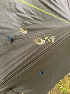
I heard a couple of loud noises this morning whilst under the tarp. I thought a bird had collided with it but when starting to take the tarp down it appeared that one or more birds might have taken exception to me being under their tree. There was a lot of it but I was able to scrape it off and then wipe down with a wet cloth.


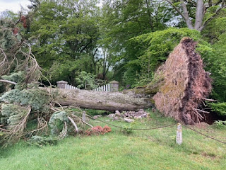
The woodland I had planned to camp in would have been fine; also around an electricity substation immediately before it. However, the exit of the path on to the road was totally blocked by a fallen tree but it would have been possible to exit just before the gate.


I road walked all the way into Brechin. There wasn't much traffic. I shopped for breakfast and lunch at the large Co-op.

All was well with my planned route until I reached a farm shown on the map as Caldcots. Here, I asked a lady walking dogs about my route as there were a couple of stretches with no right of way on the map. She wasn't sure but just then the farmer came along and I asked him. He said my route wasn't on rights of way but kindly gave me directions with advice to keep clear of cattle in a couple of places. Looking at my map, he pointed out a stretch further on where he wasn't sure there was a right of way. Sure enough, there wasn't. I went down a farm track marked private which, after a while, led to a grass track along a field margin (although shown as a white lane on the map). After this, I just trespassed along the route I wanted to go. There was no path at all and at one point I went through a hedge backwards to emerge on to a vehicle track.

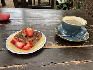
Eventually, I reached a highway and road walked to Hillside and then on to Charleton Fruit Farm where there is an excellent cafe. Here, I stopped for a coffee and a substantial chocolate, pecan and caramel tray bake. 


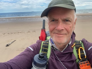
Sustained, I walked the half mile across Kinnaber Links and on to the beach to complete my Challenge. 

Kinnaber Links

It was then a walk of something over a mile down the beach to Montrose where I booked into the campsite and then on to the Park Hotel to check into Challenge Control, collect my certificate and rather good Rab t-shirt.


TGO Challenge Day 12 - 23 May 2022


Walking 7am to 2.30pm
Distance walked 10 miles
Distance remaining 15 miles

As I was packing up, Peter and Rachel Cornish passed by. They had been camped a few hundred yards back. Had a nice chat and Rachel took a photo of the three of us which she'll post to the TGO Facebook page. 

Hunthill Lodge

It was easy walking down to the end of Glen Lethnot. My planned route had been over Ordies Hill and then following landrover tracks up and then down to a narrow lane at NO512707 but it was much easier to simply follow the tarmac lane around to meet at the same point. It was a lovely morning and Road walking doesn't get much nicer with fine scenery and I ascents. For some of the way I walked with Darren Smith from Northumberland until I stopped to make coffee and he went on. In fact, as I had time to spare, I stayed for over an hour reading and admiring the view. 


Coffee stop

Eventually moving on, I took the lane that passes between White and Brown Catarthuns, Iron Age hill forts. I had lunch by the small parking area. I asked some people coming down from White Catarthun whether it was worth going up to have a look but was told that it depends what you expect to see. Hmm.

Walking on, it rained hard. I had been planning to camp in some woodland before reaching Brechin but before then I came to the Tigerton National Grid Odourless Gas Installation. It's well fenced in but inside the hedge and tree perimeter it is grassed and ideal for pitching a tarp. There's been a couple of waves of torrential rain while I've been here. Tomorrow I'll have a look at the woodland where I intended to camp. There's been so much tree damage up here lately. 

Behind the gas installation


Sent from my iPhone