Sunday, 22 April 2018

Great English Walk Day 35 - 22 April 2018

Fenton to Berwick upon Tweed
Walking 5.20am to 6.00pm
Distance walked today 24 miles
Distance walked so far 541 miles
Distance left 0 miles

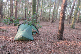
While I was lying in my tent in the wood last night, pheasants squawking, I began to think maybe I could finish the walk in one long day. I woke shortly after 4am and the thought was still there so the decision was made. I didn't even make tea. I just packed up and set off in half light.

I slept in there last night

I largely followed the official GEW route all day although, to save a little time, I road walked between the villages of Ford and Etal. There was absolutely no-one about, just the way I like it and no traffic whatsoever. Both Ford and Etal have ruined castles that will have to wait for another time.
At Ford, I went by a sign for a cycle route to Berwick which, if I followed the route, would save me three miles but the GEW guide was effusive about the riverside walking so I opted for that and am so glad I did.
Ford church and castle
Etal castle

At Etal,  I started walking alongside the River Till, the only English tributary of the Tweed, and it was, with the exception of one stretch, my constant companion for a few hours, quite lovely. I walked through the beautifully named Tiptoe Wood, the smell of wild garlic accompanying me much of the way, under an impressive railway viaduct, and then arrived at the confluence of the Till and the Tweed, not so impressive but I took a quick break here. I'd done ten miles by ten o'clock with fourteen to go.
Wild garlic!
 
The Way then followed the Tweed the rest of the day, sometimes right next to it, sometimes a way away. Now and then, there was a diversion due to land slip. The quality of the path ranged from excellent to poor, the latter where there had been a land slip and a new path wasn't fully established. I passed through the villages of Norham and Horncliffe, meeting only a couple of dog walkers.

River Tweed

Here's where the path was
During the day, I took a couple of doses of ibuprofen for a muscle strain at the top of my right leg which has been troubling me the past few days and it helped a little.
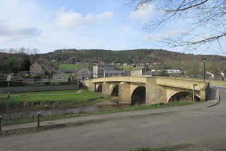
The weather having been good (not hot) all day, on crossing the A1 outside Berwick, there was a ten minute shower which I waited out rather than don waterproofs. Then a path past a sewage works. Under the Royal Border Bridge, the main line between England and Scotland, then the modern Royal Tweed Bridge and the Old Berwick Bridge and this carried me into Berwick with the youth hostel only minutes away.

Berwick
An exhausting day but well worth the effort and it means I have a day to explore Berwick tomorrow. My legs won't know what to do with themselves.

Saturday, 21 April 2018

Great English Walk Day 34 - 21 April 2018

Threestoneburn Wood to Fenton
Walking 7.35am to 6.20pm
Distance walked today 15 miles
Distance walked so far 517 miles
Distance left 27 miles (in fact, according to the map, 24 miles)

Waking at 5am, there was such a cacophony of noise from the dawn chorus, mainly pigeons competing with one another, and also a cuckoo.

I was able to have a leisurely start so made tea from my "bedside" and read a little, putting off the unpleasant moment when I had to put on my socks, chilly and wet from yesterday's late drenching, followed by wet shoes although, to be honest, it isn't such a big deal now.

Dropping down to Harthope Burn at NT953225, there's reasonable camping by the wooden footbridge and, of course, plenty of water. Having said that, from the other direction, approaching the area from the road, there is a Northumberland National Park sign prohibiting camping.

Harthope Burn

The way to Wooler, via Broadstruther, involved a long climb to reach open moorland but, with a clear sky and the temperature warming up, it was quite perfect. Further on, where Carey Burn was reached, I took a break for elevenses and dunked my feet in the water for a few cold minutes. At Wooler Common I stopped for a chat to Karen Balmbro who was walking her dog, a colly, I think. I gave her one of my flyers.


Wooler meant the moorland walking was over, now just flatter farm land until Berwick. I did a final resupply in Wooler and pressed on. Being so low, it was getting quite hot which didn't suit me one bit. There was virtually no breeze.


Near Doddington, I was taking a break when someone else to talk to came by - Mary Short, walking her retired greyhound, Magic. He was on a very short leash as he would have been off after hares. Marys father has recently died from bone cancer. So many people are affected by cancers, either directly or indirectly. It's amazing how a distraction like meeting someone to talk to gives my legs a new burst of energy and I made quick work of the fields to Fenton. I could have gone further, and intended to, but the other side of Fenton I found a perfect woodland pitch for the night.


Friday, 20 April 2018

Great English Walk Day 33 - 20 April 2018

Kidland Forest to Threestoneburn Wood
Walking 7.50am to 6.15pm
Distance walked today 12 miles
Distance walked so far 502 miles
Distance left 42 miles

The night's pitch was actually very good. So much of the forest I passed this morning had been felled. There might have been some possibilities a mile or so further on but a good decision was made to stop where I did.

Leaving the forest, the views really opened up as I descended on a good grassy path to Uswayford, said to be one of the most remote farms in England.


Past Uswayford, my guide book and the map indicate a path immediately to the left of Clay Burn. I tried it but it was very difficult so I turned back and used the path just above it through the forest but not shown on the map but there was a stile leading to it. It bisected a good track just east of Davidson's Linn waterfall. The track went east (the right direction) and is shown on the map as Salter's Road, used for transporting salt in times gone by.

Past Nagshead Knowe, I made a possibility bad choice of route. The GEW takes a high level route over High Cantle, eventually dropping down to Linhope. I took a probably easier way past High and Low Bleakhope farms, all very easy and much on a tarmac farm road. It was very scenic and quite lovely but, because the area south of Linhope was off my map, I didn't know that the road didn't go to Linhope. Consequently, I had to walk beyond it and then had a quite rough and wet traverse of a pasture to regain the GEW route below Dunmoor Hill.

I had then been expecting a relatively easy walk through Threestoneburn Wood (a forest) but virtually all of it had been harvested leaving a very forlorn wasteland. The first few hundred yards were almost pathless and, in a wet section, my right leg went in to just below knee level. Not nice. I then found a forest "road" which made for easy walking.

The approach to Threestoneburn House was over a pathless felled area, whereas the guide book, written when the forest was still standing, indicated a clear and easy path. Oh well.

I had been planning to wild camp by Harthope Burn but thought that if it was no good, the country beyond didn't look promising. So I filled up with water from a burn and found a good forest pitch just past the forest road north of Threestoneburn House. I'll report in tomorrow's posting whether Harthope Burn would have been OK.


I heard my first cuckoo of the year this evening.

Thursday, 19 April 2018

Great English Walk Day 32 - 19 April 2018

Rothbury to Kidland Forest
Walking 9.50am to 6.30pm
Distance walked today 12 miles
Distance walked so far 490 miles
Distance left 54 miles

A late start as I couldn't have my full English till the café staff arrived at 9 although I surprised the sprightly nearly 80 year old cleaning lady who hadn't known of my presence as her day off was yesterday.
Rothbury
Today was the "best" weather day so far and the first day I wore just my shirt on top. Having said that, yesterday's weather was better for me as a walker being cloudy but warm. Rothbury is a place to return to and explore.

I'd got food for the next couple of days at the Co-op in Rothbury last night. My list of places with some sort of food shop included the next village of Thropton. A local I met on the way down into the village confirmed that, as of April 2018, there is no shop.

Today's lunch stop

I walked out of Thropton alongside the River Coquet, got a water bottle refilled by a lady at Sharperton and then road walked to the village of Harbottle, very small now but, in the 12th century, it was the capital of Redesdale. The last wolf in England is said to have been killed near here in 1750. I crossed the river here to follow a good riverside path which took me on to Alwinton.

River Coquet at Sharperton

I last came by here in 2007 on my Lakeland to Lindisfarne walk, when Frank, Howard and I managed to persuade the nearby Clennell Hall caravan park to let us camp there overnight. The sign board I passed indicated that camping was "available" there so maybe a change.

Past Alwinton, I began the long ascent on a wide track known as Clennell Street, an ancient "road" which ran from Alwinton, over the Cheviots, to Cocklawfoot, some 19km away, used by drovers. In fact, last year I camped on Clennell Street where it crosses the Pennine Way. I shall pass within about a mile of it tomorrow. I vividly remember it being extremely windy that night.

Various parts of Kidland Forest have been felled. I had planned to camp about a mile further on from where I am but it looked as if large areas had been felled ahead so I found a nice pitch in the forest. The birds have been quite noisy but have quietened down for the moment.


Wednesday, 18 April 2018

Great English Walk Day 31 - 18 April 2018

Forest south of Birney Hill to Rothbury
Walking 7.00am to 4.45pm
Distance walked today 18 miles
Distance walked so far 478 miles
Distance left 69 miles

I slept surprisingly well. The uneven ground didn't bother me. I was pitched on the path through the forest but I didn't expect any passers by, it was so remote.

My route was easier to follow than I thought it would be. My feet were wet within a couple of minutes but, really, that made the going easier as I didn't need to waste time trying to avoid wet ground. There was only one public footpath and it was adequately waymarked.


Past Sweethope, I abandoned the GEW for much of the day and opted for a slightly more direct route to Rothbury. I took the minor road east to the A696 Jedburgh-Newcastle road to Knowesgate where I joined the St. Oswald's Way, which I followed for the rest of the day. Along the lane near Knowesgate, I saw a tree. It was a very unusual tree. A shoe tree. I don't know what sort of tree it actually was but its branches were festooned with countless pairs of shoes, trainers, wellies, etc. I've never seen anything like it.


The Way is a 97 mile route which links some of the places associated with St. Oswald, the King of Northumbria in the early 7th Century, who played a major part in bringing Christianity to his people. It was very well waymarked so I think I made a good choice.

About six miles were through Harwood Forest, the first four on forest roads and the last two on a narrow path but easy to follow. Emerging from the forest, the path continued over moorland, muddy in places, before dropping down to a car park and then going up and over a hill when I could see Rothbury a mile away.


After two nights wild camping, a shower was needed so I'm overnighting at Tomlinson's Bunkhouse. In fact, I'm the only occupant. The cafe downstairs closed at 5.30 so all has been quiet since then. I've washed a few items of clothing which will finish drying on my pack tomorrow. I'm not quite sure what to do about my shoes which smell really offensive, even to me, as I've walked through liquid cow and horse poo today. In one place, in particular, I could hardly see my shoes it was so deep.

Having had two long days, I now have five days to do the final 69 miles so I can take it easy just a little.

Tuesday, 17 April 2018

Great English Walk Day 30 - 17 April 2018

Plankey Mill to forest south of Birney Hill
Walking 6.40am to 7.40pm
Distance walked today 20 miles
Distance walked so far 460 miles
Distance left 92 miles

An early start to get the final mileage down. I continued walking alongside and above the River Allen until I emerged into a National Trust car park with open loo facilities which was very convenient. Although the GEW route goes through Bardon Mill, that was out of my way and I was too early for any shop that might be open so I walked along roads and tracks northwards to the Housesteads museum (closed till 10am) and Hadrian's Wall. As Housesteads wasn't open, I had to climb fences to get into the area containing the remains of the Roman buildings and out again the other side.


I walked the Wall path for half a mile but it was very up and down with more to come so I dropped down to the B6318 which runs south of the Wall but without the undulations and followed this for 1.5 miles until a point where the Wall path descended to meet and run alongside the road and so rejoined it. In the two miles I walked this section, I passed more walkers than in the whole of this journey so far, I think.

Where the Wall path switches to the other side of the road, I took a bridleway north and then a little used lane past High and Low Moralee farms, before arriving in Wark where I bought a few food items and a very sparsely stocked shop.

The bridge at Wark

Crossing the River North Tyne, I walked to Birtley. Here I met Lesley Gosling who kindly filled a water bottle (and gave me a glass of orange juice) and, after hearing of my walk, sent me on my way with home baked cheese scones and a satsuma. It cheered me up no end.

From Birtley, I took field paths to the A68 and then a long farm track and over a couple of fields to enter the forest. I'm camped maybe a hundred yards inside but, so far, there isn't a proper path, just rough tussocky grass between densely planted conifers. It's very wet underfoot so I shall negotiate my way through in the morning. I'm not really looking forward to it! Anyway, the remaining mileage is now down to double digits.


Monday, 16 April 2018

Great English Walk Day 29 - 16 April 2018

Blanchland to Plankey Mill
Walking 8.50am to 6.20pm
Distance walked today 17 miles
Distance walked so far 440 miles
Distance left 115 miles

Frank provided a magnificent breakfast - egg, bacon, sausage and black pudding rolls with coffee. What a star - and a good friend.

He drove me back to Blanchland. I forgot to mention in yesterday's posting that, having reached Blanchland, I am now in the final county of the GEW, Northumberland.


Following the route of the GEW, I went four miles west as far as the abandoned farm at Riddlehamhope. Just before then, the path went through a belt of woodland that would have made a very nice wild camp had it been at the end of the day.


The route then turned northward to the farm of Harwood Shield and then west, where it entered the long traverse of Hexhamshire Common, a wide open heather-covered moorland. Half way across I managed a late elevenses out of the constant wind in an unlocked shelter hut, presumably used mainly by grouse shooters. It was very welcome.

Hexhamshire Common
I eventually reached a road that took me down into Allendale Town. I was pleasantly surprised that the whole of the route was clearly defined, not what I was expecting. I bought a few things from the Co-op before moving on. I was last here in 2007, catching a bus to Hexham on a Lakeland to Lindisfarne traverse, having got quite wet after 36 hours of constant rain and heading to the youth hostel at Once Brewed to dry out.

From Allendale, I followed a lovely riverside path alongside the River Allen, which I largely remained close to for the rest of the day. Entering National Trust woodland, I came across the site of a hilltop fortification called Staward Peel, almost all evidence of it long since gone but interesting nonetheless. The path then meandered steeply down to join another up and down riverside path before emerging into a field at Plankey Mill, a farm. Here, my guide book told me I would cross the river by a suspension bridge but this had at some time been replaced by another bridge.

Over the bridge I entered the 29 acre Briarwood Banks Nature Reserve and, although I had intended walking further, I didn't think I would find a finer wild pitch so here I stopped. I was able to freshen up my feet in the nearby river.


A good day weather-wise, no rain and a decent distance covered.

Great English Walk Day 28 - 15 April 2018

Stanhope to Blanchland
Walking 8.15am to 1.40pm
Distance walked today 11 miles
Distance walked so far 423 miles
Distance left 132 miles

For reasons that will become clear, I was able to leave my pack at the site (under a caravan) and walk with just my chest pack (converted for use as a shoulder bag), waterproofs and a water bottle.

I crossed the River Wear by a stepping stone bridge. 


After a short road walk out of the village, I took a footpath by the medieval bridge which followed a course between the river and a disused railway. After a while, the path became so churned up by cows that I walked the railway line for a while before passing through a caravan park.


At Eastgate, I followed a path through fields but following Rookhope Burn and then walked into Rookhope. It was getting misty so I decided to road walk even though the distance was slightly longer. The road climbed and the fog descended although it wasn't particularly cold. A few vehicles passed me and quite a few cyclists as this was part of the C2C route. It felt very remote. I took a photo of a dead animal on the road, not quite sure what it was and couldn't work out how it had died as there no obvious injury.

Descending to Hunstanworth and then Blanchland (following the riverside path) I called it a day and had lunch overlooking the river bridge. My friend, Frank, arrived some 40 minutes later to take me back (via Stanhope for my pack) to his home at Westgate to be fed and watered. He and his wife, Sally, were excellent hosts. I met Frank walking the Pennine Way last year and we've kept in touch. I shall be delivered back to Blanchland in the morning.

The Lord Crewe Arms, Blanchland


Saturday, 14 April 2018

Great English Walk Day 27 - 14 April 2018

Romaldkirk to Stanhope
Walking 8.45am to 4.00pm
Distance walked today 11 miles
Distance walked so far 411 miles
Distance left 142 miles*

I breakfasted with Charlie and Jeanette and they pointed me in the right direction, after Jeanette gave me a hug. Such lovely people to have met purely by chance. Thank you both for your kindness.


It was set to be a decent weather day. I had a route choice to make, given that I need to complete this walk by Monday, 23 April. The GEW route today, just past the village of Eggleston, would take me on a wide loop eastwards through Hamsterly Forest. Alternatively, and this is what I did, I could walk on a relatively quiet road virtually straight from Romaldkirk to Stanhope. There were a couple of long inclines but the moorland views were clear and wide ranging. It was quite enjoyable and cut seven miles out. If over the next few days I see similar opportunities I shall take them. My main aim is to walk all the way from Chepstow to Berwick and not slavishly follow the route of the GEW, good though it is. Thus, the mileage figures at the top of the blog postings appear inconsistent.


Once I reached Stanhope, I was planning to find a wild camp. I could see some patches of woodland beyond the village as I descended from the moorland. However, coming into the village, I could see a dozen or so motorhomes and caravans just off the road so I wandered in. What it was was a five day meet of the Camping and Caravanning Club, not an actual campsite. As I am a member I was made welcome and paid my £7.00. There are proper loo facilities here. A nearby couple, John and Sheila invited me into their caravan for a cup of tea. Other people have been very friendly.

Great English Walk Day 26 - 13 April 2018

Near to CB Inn, Arkengarthdale to Romaldkirk
Walking 8.00am to 7.00pm
Distance walked today 15 miles
Distance walked so far 400 miles
Distance left 183 miles*

Once again, many thanks to Lee for the provision of a pitch for the night. We were lulled to sleep by the rushing of the nearby river. Lee wasn't around when we left.

It was a foggy morning, again, as we continued our road walk up to The Stang. It was generally uphill most of the way, about three miles. Some of the forest had been felled and replanted. Further on, there would have been possibilities for stealth camping here and there.

After the forest, the quiet road continued to the A66 dual carriageway which was busy in both directions so we took our time in crossing safely. On then into Barnard Castle.

At the beginning of this walk, I had bought a cheap lightning to USB lead for my iPhone but, when connecting my iPhone to a battery pack for recharging, it had proved unreliable. Howard had lent me his but in Barnard Castle, a computer shop, Tinker Dog, was able to sell me a genuine Apple lead. The proprietor (whose name I forgot to ask) gave me a donation for Ucare, so kind.

Howard and I then went over the road to a cafe for egg and bacon sandwiches and coffee. Howard was heading back home from here tomorrow. I had planned to walk with him to his campsite so we went the short way to a footbridge over the River Tees. When we got to it, it was closed for some reason. Therefore, we parted company at that point, he to go back to town and to his campsite another way and I went on following the Teesdale Way alongside the river. It was generally a good path, although muddy in places. It was good to have had company for a couple of days.

Along the Tees
Near Cotherstone, however, it all came to grief, navigation-wise. My aim had been to find a wild camp further on in Hamsterly Forest. My route took me through a caravan park. First, I managed to exit it the wrong way. A farmer gave me directions but I couldn't find the right way. I found myself going through the caravan park again. A resident gave me directions but I found myself going in a circle again! To avoid a third visit to the caravan park, I crossed the bridge towards Cotherstone and rejoined the Teesdale Way but I couldn't find the path past a farm (Woden Croft) so made my way by the farm road to the B6277 into Romaldkirk. I clearly wasn't going to get to Hamsterly Forest before nightfall.

I thought of stealth camping in the churchyard but a couple I met, Charlie and Jeanette, walking their dog, Barney (the second Barney dog on this walk), offered me facilities at their home nearby. Absolutely amazing. We have spent a delightful evening over spaghetti bolognese and wine putting the world to rights and I've had a welcome shower. Were were later joined by their friend, Lesley and her dog. I shall spend a warm night stretched out on a settee in front of the fire.

A serendipitous end to the day.

* Mileage remaining - according to my maps, I have 161 miles left to do. I haven't stuck precisely to the GEW route by any means so this may account for the discrepancy. I'll work it out when I get home. I've certainly walked every inch of the way so far.

Thursday, 12 April 2018

Great English Walk Day 25 - 12 April 2018

Leyburn to Arkengarthdale
Walking 8.30am to 4.00pm
Distance walked today 10 miles
Distance walked so far 385 miles
Distance left 198 miles


A foggy day but, at least, no rain. We walked into and through Leyburn, taking the minor road north over Bellerby Moor. For much of the way, we heard regular gunfire, the map showing "Danger Area" and "Rifle Range" on either side of the road. There were too many lorries and other traffic for our liking and, at the first opportunity, we left the road for a track across the moor that went in the direction we wanted to go and, over Preston Moor, we were once again on the Great English Walk. The route was generally easy to follow, despite the fog. Various land features and buildings showed evidence of widespread lead mining in former times.

Emerging at Grinton, we called in at The Bridge for coffee, which then morphed into soup for lunch. We then passed through Reeth and took a minor road in the general direction of Kirkby Stephen. We were planning to head for a forested area called The Stang but, before then we went into The CB Inn (it stands for Charles Bathurst), a lovely remote pub, serving food and providing accommodation. We met such kind people there. Mandy, behind the bar, made a spontaneous and generous donation to Ucare and took a photograph of us for The CB's Instagram page.


We got talking to Lee Kettlewell, who lives nearby. On discussing our intended overnight pitch, he thought we might find it inhospitable and offered us a pitch in the field next to his house, where we are now. We returned to The CB for a meal this evening. It was a lot busier than this afternoon; obviously a very popular place. On going to pay, Mandy took us aback by saying that the management had agreed that the cost of our meal would be a donation to Ucare as well. I was quite overwhelmed. Such kindness. I've promised to get in touch when I get home. Thank you Mandy, the CB management and Lee.


Not such a great distance covered today but a camping opportunity not to be turned down.

Wednesday, 11 April 2018

Great English Walk Day 24 - 11 April 2018

Masham to Leyburn
Walking 9.30am to 2.15pm
Distance walked today 10 miles
Distance walked so far 375 miles
Distance left 208 miles

I had quite a leisurely start to the day and enjoyed a full English breakfast. My tent was completely dry, having been draped across the bath and shower screen all night, and much lighter to carry.

Out of Masham, I crossed the River Ure and took the minor road up the right hand side. At times there was a flow of water a quarter to half inch deep on the road surface and this resulted in slightly wet feet quite quickly. The road was also flooded on one side or another in places so I had to make sure there was no traffic before I walked in the middle of the road.

Past Charlcot, the metalled road became a track and was severely flooded now and then but I managed to get around each time, although once I nearly slipped and fell in; it was only a foot deep!

Further on, I stopped to chat with a fellow on a horse who told me I could get a cup of tea in the next village. So, in Thornton Steward, I looked out for the Institute building, essentially a small village hall maintained by volunteers and supported by donations. What an excellent place. I went in and made myself tea and there was a loo at the back. A local volunteer came in to do some cleaning and we passed the time chatting for a few minutes before he disappeared to get busy. He told me walkers make good use of the facilities.


From there, I walked through the parkland of Danby Hall, a very imposing residence. 


I had lunch in Spennithorne church. 


In the churchyard was a golden cross that had been brought back from Sebastopol during the Crimean War. 

Am camped at Cracken House campsite, a really excellent place, and here I have been joined by Howard Kelly, a fellow Backpackers Club member, who has travelled up from Hampshire to walk with me until Barnard Castle, which we should reach on Friday/Saturday. Richard, the owner, very kindly ran me into Leyburn, a mile away, as I needed to get some food supplies. He very generously donated my and Howard's camping fees to Ucare. Howard and I have had a meal and a pint at the Golden Lion in Leyburn.