My insides still aren't right and I'm not fancying any of the food I've brought with me and rather lacking in energy levels as a result. I took the decision yesterday to save the rest of this walk for another time. However, any final decision was taken out of my hands this morning when I put my back out! I won't disclose what I was doing that precipitated it. So, this walk will be continued at another time.
Hawes is an excellent place to spend a couple of days. Have visited friends who live here and this is the home of Wensleydale cheese so not all is doom and gloom. It's appropriate to describe the Way as Wallace might - "Cracking good walk, Gromit!" The North of England Way is very good. How does it compare with the Wainwright Coast to Coast? Well, I did that some ten years ago so I can't really remember but it is well worth doing. The route from here would be Bainbridge, Askrigg, Aysgarth Falls, Castle Bolton, Thirsk and then over the North York Moors to Helmsley, Scalby and then a short way down the coast to Scarborough. Without exception, those I met along the way would say that they'd never heard of it. It's none the worse for that though. Although the book of the Way by David Maughan is out of print, it's available on Amazon second hand.
Sunday 29 June 2014
Friday 27 June 2014
North of England Way Day 6 Friday 27 June
Stoops Moss to Hawes
Miles walked 11
Miles left 117
Walking from 6am to 11am
I was woken at 2.15am by the sound of the gate shutting into/out of North Yorkshire only a few feet away. It wasn't that dark but surely no-one could be out walking at that time. There was no other sound so I went back to sleep.
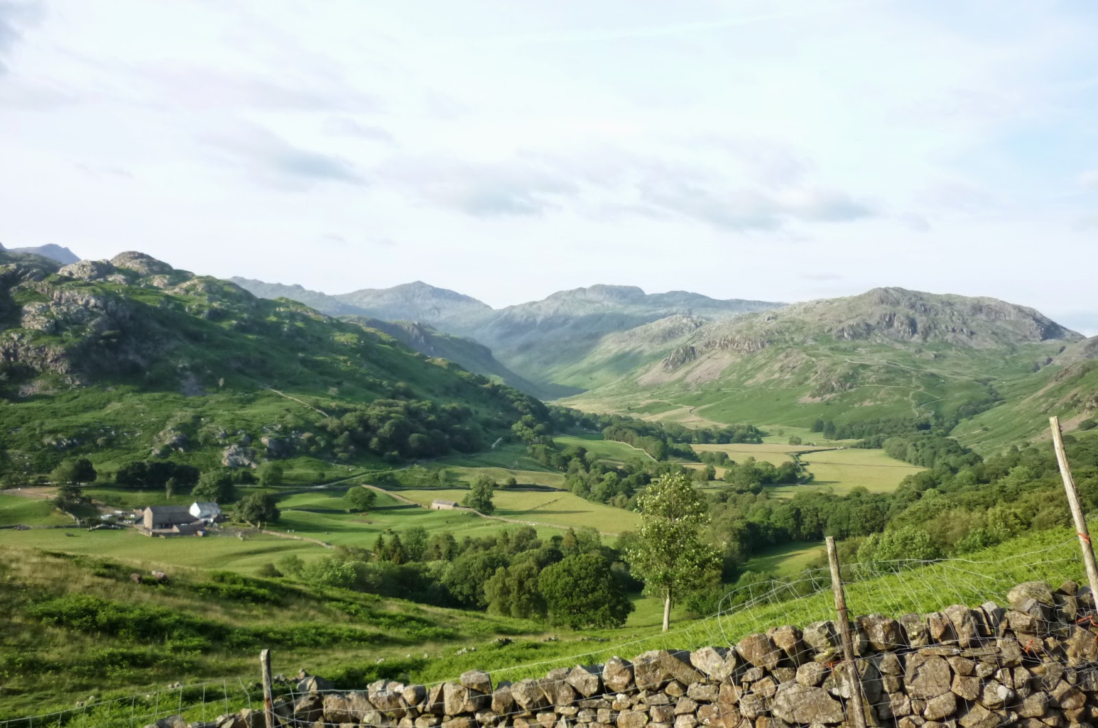
Off early again, the path over Gayle Moor was generally good but could be boggy in parts if wet. Shortly before High Gayle, there is a fork where the main and obvious track (which is a vehicle track at this point) continues ahead with a grassy path (with a new footpath signpost to Gearstones) to the right. That is the way to go. It passes above High Gayle Farm and gradually descends to Winshaw and then to the B6255. Turning left for two hundred yards, the Dales Way starts a long 1.5 mile ascent to High Cam, meeting with the Pennine Way which joins it from the right. There are currently forest operations going on in Cam Woodlands so the track has been upgraded for lorry use. I saw one go up it from a distance and, when I was on it, a 4x4 went by and threw up a lot of dust.

After a couple of miles further, the Dales Way continued off to the right, signposted Oughtershaw, and I carried on along the Pennine Way.

It was level walking on a rough vehicle track for maybe four miles before branching off on a grassy path and eventually starting a long descent into Gayle and then Hawes, which was busy with tourists and bunting out for the Tour de France cyclists passing through the weekend after next. I'm taking a day off tomorrow so normal service will hopefully resume on Sunday. I say "hopefully" as this nausea and tummy unsettledness isn't going away. We shall see. This is supposed to be a holiday, after all and I cannot afford to take time off work when I get home.

Miles walked 11
Miles left 117
Walking from 6am to 11am
I was woken at 2.15am by the sound of the gate shutting into/out of North Yorkshire only a few feet away. It wasn't that dark but surely no-one could be out walking at that time. There was no other sound so I went back to sleep.
Off early again, the path over Gayle Moor was generally good but could be boggy in parts if wet. Shortly before High Gayle, there is a fork where the main and obvious track (which is a vehicle track at this point) continues ahead with a grassy path (with a new footpath signpost to Gearstones) to the right. That is the way to go. It passes above High Gayle Farm and gradually descends to Winshaw and then to the B6255. Turning left for two hundred yards, the Dales Way starts a long 1.5 mile ascent to High Cam, meeting with the Pennine Way which joins it from the right. There are currently forest operations going on in Cam Woodlands so the track has been upgraded for lorry use. I saw one go up it from a distance and, when I was on it, a 4x4 went by and threw up a lot of dust.
After a couple of miles further, the Dales Way continued off to the right, signposted Oughtershaw, and I carried on along the Pennine Way.
It was level walking on a rough vehicle track for maybe four miles before branching off on a grassy path and eventually starting a long descent into Gayle and then Hawes, which was busy with tourists and bunting out for the Tour de France cyclists passing through the weekend after next. I'm taking a day off tomorrow so normal service will hopefully resume on Sunday. I say "hopefully" as this nausea and tummy unsettledness isn't going away. We shall see. This is supposed to be a holiday, after all and I cannot afford to take time off work when I get home.
North of England Way Day 5 Thursday 26 June
Near Thwaite to Stoops Moss
Miles walked 18.5
Miles left 128
Walking 5.45am to 7.34pm
It rained lightly on and off in the night but I was able to pack away after it had stopped. The path was easy to follow south towards Sedbergh. I stopped for a minute or two to watch a heron preening itself on a rock down in the river below.

I went into Sedbergh and found again the shop I'd visited in 2009 on my LEJOG and bought a couple of excellent meat pies to sustain me. The steak and Guinness one I shovelled down mid morning couldn't have tasted better. While I was eating it a Dales Way walker with a dog came by. He couldn't carry a pack due to a shoulder problem and so had made a two wheel carrier that he had strapped to a belt he was wearing. His pack was on it and occasionally the dog was carried as well. The Way then dropped down into Dentdale, passing through the picture postcard hamlet of Millthrop.


The River Dee was followed along the edge of meadows to Dent where their annual festival was getting under way. There were to be musical events (Midge Ure, for one) and a beer festival. People were arriving with tents and campervans.

My queasiness from yesterday had returned during the morning. In Dent, I visited a tearoom for a pot of tea and a toasted teacake and a couple of times there I came out in a sweat and felt quite nauseous and, unusually for me, wasn't able to finish the teacake. Leaving Dent, the walking was easy, just switching from one side of the river to the other from time to time. The weather was cloudy all day but dry so ideal really. Approaching the hamlet of Cowgill, I opted to stick to the lane rather than follow the Dales Way at a higher level. There was very little traffic. After Cowgill, the road passed beneath the Dent Head Viaduct which carries the Settle-Carlisle railway. According to my book of the North of England Way, a local farmer was asked why Dent station is 4 1/2 miles from the village. Apparently, he replied that it was because they wanted the station near the railway line! There were three more miles of tarmac before leaving the road to enter the wild moorland of Stoops Moss. I pitched about half a mile in on the first reasonable pitch. It's quite tufty but comfortable enough. The fence and stile I'm next to mark the boundary between Cumbria and North Yorkshire. The weather has turned quite breezy and chilly. The curlews were quite vocal at first but quieter now and there's a lapwing as well. I can see the profile of Penyghent in the distance. I shall be joining the Pennine Way tomorrow.

Sent from my BlackBerry® smartphone
Miles walked 18.5
Miles left 128
Walking 5.45am to 7.34pm
It rained lightly on and off in the night but I was able to pack away after it had stopped. The path was easy to follow south towards Sedbergh. I stopped for a minute or two to watch a heron preening itself on a rock down in the river below.
I went into Sedbergh and found again the shop I'd visited in 2009 on my LEJOG and bought a couple of excellent meat pies to sustain me. The steak and Guinness one I shovelled down mid morning couldn't have tasted better. While I was eating it a Dales Way walker with a dog came by. He couldn't carry a pack due to a shoulder problem and so had made a two wheel carrier that he had strapped to a belt he was wearing. His pack was on it and occasionally the dog was carried as well. The Way then dropped down into Dentdale, passing through the picture postcard hamlet of Millthrop.
The River Dee was followed along the edge of meadows to Dent where their annual festival was getting under way. There were to be musical events (Midge Ure, for one) and a beer festival. People were arriving with tents and campervans.
My queasiness from yesterday had returned during the morning. In Dent, I visited a tearoom for a pot of tea and a toasted teacake and a couple of times there I came out in a sweat and felt quite nauseous and, unusually for me, wasn't able to finish the teacake. Leaving Dent, the walking was easy, just switching from one side of the river to the other from time to time. The weather was cloudy all day but dry so ideal really. Approaching the hamlet of Cowgill, I opted to stick to the lane rather than follow the Dales Way at a higher level. There was very little traffic. After Cowgill, the road passed beneath the Dent Head Viaduct which carries the Settle-Carlisle railway. According to my book of the North of England Way, a local farmer was asked why Dent station is 4 1/2 miles from the village. Apparently, he replied that it was because they wanted the station near the railway line! There were three more miles of tarmac before leaving the road to enter the wild moorland of Stoops Moss. I pitched about half a mile in on the first reasonable pitch. It's quite tufty but comfortable enough. The fence and stile I'm next to mark the boundary between Cumbria and North Yorkshire. The weather has turned quite breezy and chilly. The curlews were quite vocal at first but quieter now and there's a lapwing as well. I can see the profile of Penyghent in the distance. I shall be joining the Pennine Way tomorrow.
Sent from my BlackBerry® smartphone
Wednesday 25 June 2014
North of England Way Day 4 Wednesday 25 June
Just south of Staveley to just north of Thwaite on River Lune
Miles walked 11.5
Miles left 146.5
Walking from 10.30am to 8pm
Showered and clean shaven, I set off down the lane from the CCC site. It's quite a size and has its own pub and basic restaurant. The site was by no means full and was very quiet. I started today with a new pair of Inov8 Terrocs which I've had in reserve for over a year, bought at a good price when they were about to be discontinued. The sole of one of my old ones had split open and they were generally falling apart.
I took a short cut through woodland to cross the A591 and then over a bridge below which was the single track line to Windermere. I rejoined the Way at Bowston. Just before Burneside, following the riverside path, I stopped to chat with four ladies walking the Dales Way. They were B&B-ing and having baggage carried and enjoying the walk very much. I passed a few other small groups probably doing the same. The way the grass was trodden, it would seem that most folk doing the Dales Way start at Ilkley and finish at Windermere rather than the way I'm going. Burneside was the place to find some decent bread for lunch. I passed by the chain convenience store and made enquiries about a bakery which I believed was there. I was told that the lady owner's husband had just died and it might not be open but I'm glad to say it was. My bread rolls had only just come out of the oven and were too hot to hold. Burneside also has a pub and fish and chip shop. During the morning, I felt a lethargy and vague queasiness come on and I really don't know why. Walking with a pack was a bit of a chore but I plodded on. The feeling stayed with me for the rest of the day. The path was quite easy to follow although there were many stiles and gates. At Patton Bridge, my route book said that 50 miles had been covered but my digital mapping indicated only 48. Anyway, I'm well and truly out of the Lake District National Park. As I was about to cross the A6 north of Kendal, I came across Dave and Phil, cycling Lands End to John O'Groats. They were collapsed, waiting for their friend with the support van to arrive and give them lunch. He arrived and kindly offered me a cup of tea which was a life saver. They're doing the ride for two charities - see http://virginmoneygiving.com/team/lejoggers2014 I was happy to give a donation.

On from there at a farm just across the A685 I met Emily Walker, waiting for the owners to return home to sort out where she could camp. I passed the time of day briefly but then she mentioned that she was WALKING LEJOG so I sat down and we chatted for a while. She hadn't met anyone on her walk who was doing it so I was the next best thing as someone who has done it before. She's walking for charity and blogging - see http;//emjwalker.blogspot.com

I crossed the noisy M6, stopped to cook a meal next to Crook of Lune Bridge. The light drizzly rain kept most of the midges at bay. I didn't have the stomach for all the meal but I needed to eat. The other side of the bridge, I walked alongside the river. I walked through some rather muddy woodland but that came to an end and I'm camped back from the river out of sight unless anyone comes down from the farm.
Sent from my BlackBerry® smartphone
Miles walked 11.5
Miles left 146.5
Walking from 10.30am to 8pm
Showered and clean shaven, I set off down the lane from the CCC site. It's quite a size and has its own pub and basic restaurant. The site was by no means full and was very quiet. I started today with a new pair of Inov8 Terrocs which I've had in reserve for over a year, bought at a good price when they were about to be discontinued. The sole of one of my old ones had split open and they were generally falling apart.
I took a short cut through woodland to cross the A591 and then over a bridge below which was the single track line to Windermere. I rejoined the Way at Bowston. Just before Burneside, following the riverside path, I stopped to chat with four ladies walking the Dales Way. They were B&B-ing and having baggage carried and enjoying the walk very much. I passed a few other small groups probably doing the same. The way the grass was trodden, it would seem that most folk doing the Dales Way start at Ilkley and finish at Windermere rather than the way I'm going. Burneside was the place to find some decent bread for lunch. I passed by the chain convenience store and made enquiries about a bakery which I believed was there. I was told that the lady owner's husband had just died and it might not be open but I'm glad to say it was. My bread rolls had only just come out of the oven and were too hot to hold. Burneside also has a pub and fish and chip shop. During the morning, I felt a lethargy and vague queasiness come on and I really don't know why. Walking with a pack was a bit of a chore but I plodded on. The feeling stayed with me for the rest of the day. The path was quite easy to follow although there were many stiles and gates. At Patton Bridge, my route book said that 50 miles had been covered but my digital mapping indicated only 48. Anyway, I'm well and truly out of the Lake District National Park. As I was about to cross the A6 north of Kendal, I came across Dave and Phil, cycling Lands End to John O'Groats. They were collapsed, waiting for their friend with the support van to arrive and give them lunch. He arrived and kindly offered me a cup of tea which was a life saver. They're doing the ride for two charities - see http://virginmoneygiving.com/team/lejoggers2014 I was happy to give a donation.
On from there at a farm just across the A685 I met Emily Walker, waiting for the owners to return home to sort out where she could camp. I passed the time of day briefly but then she mentioned that she was WALKING LEJOG so I sat down and we chatted for a while. She hadn't met anyone on her walk who was doing it so I was the next best thing as someone who has done it before. She's walking for charity and blogging - see http;//emjwalker.blogspot.com
 |
| Emily |
I crossed the noisy M6, stopped to cook a meal next to Crook of Lune Bridge. The light drizzly rain kept most of the midges at bay. I didn't have the stomach for all the meal but I needed to eat. The other side of the bridge, I walked alongside the river. I walked through some rather muddy woodland but that came to an end and I'm camped back from the river out of sight unless anyone comes down from the farm.
Sent from my BlackBerry® smartphone
North of England Way Day 3 Tuesday 24 June
Loughrigg Tarn to Staveley
Miles walked 14
Miles left 158
Walking from 6.30am to 5pm
My wood last night was very peaceful. I was out of sight and a dog walker at 6am may or not have seen me but clearly wasn't interested. Within a minute I was on the path to Ambleside, a path that climbed to reveal far reaching views over Windermere. A clear sunny morning although it turned out to be not as hot as the previous two days and none the worse for that. I stopped to admire the view from Jenkin's Crag. It was good but not as stunning as the vista from the highest point on Walna Scar Road yesterday. I stopped for breakfast at 8 o'clock and hit Ambleside for nine to pick up something for lunch. It seemed that every other shop sold outdoor gear.
Today's walk so far and down to Windermere (the town) follows the same route as the Cumbria Way so it was vaguely familiar from about ten years ago. The path is so clear and well used that you can't really go wrong, except that I did, which I put down to concentrating on listening to a couple of chapters of John Muir's A Thousand Mile Walk To The Gulf. I took the track north towards Troutbeck instead of dropping down to Town End. Still that was easily put right.
The route went over the viewpoint at Orrest Head where I stopped for a quick, peaceful lunch to admire the view. The peace was shattered by the arrival of a class of primary school children so I left them to it and dropped down through woodland into Windermere. I didn't stop there and went out past the station on the A591 for about half a mile to find my path which crossed the railway into a housing estate at Heathwaite. This had obviously been built since my book of the walk had been written but it wasn't a problem. There followed a climb up to School Knott and a descent to the corner of a small tarn. A short distance on from that I joined the Dales Way and will now be on it for the next forty miles to High Cam on the Pennine Way.
I got a bit muddled at GR446966. I arrived at a gate leading on to a walled track but the only sign was to the left saying Dales Way Bridleway. I should have trusted the compass and taken the walled track instead of going left! For anyone taking this route, the walled track is right and it leads down to a lane down to a farm marked Fell Plain on the map from where there was a longish climb up another lane towards Staveley. I've diverted to the CCCP site for tonight to meet with my support team for a decent meal preceded by crisps and wine (a backpacker's life is so hard).
I enjoyed today but somehow it seemed longer than it actually was.
Miles walked 14
Miles left 158
Walking from 6.30am to 5pm
My wood last night was very peaceful. I was out of sight and a dog walker at 6am may or not have seen me but clearly wasn't interested. Within a minute I was on the path to Ambleside, a path that climbed to reveal far reaching views over Windermere. A clear sunny morning although it turned out to be not as hot as the previous two days and none the worse for that. I stopped to admire the view from Jenkin's Crag. It was good but not as stunning as the vista from the highest point on Walna Scar Road yesterday. I stopped for breakfast at 8 o'clock and hit Ambleside for nine to pick up something for lunch. It seemed that every other shop sold outdoor gear.
 |
| The descent into Ambleside |
The route went over the viewpoint at Orrest Head where I stopped for a quick, peaceful lunch to admire the view. The peace was shattered by the arrival of a class of primary school children so I left them to it and dropped down through woodland into Windermere. I didn't stop there and went out past the station on the A591 for about half a mile to find my path which crossed the railway into a housing estate at Heathwaite. This had obviously been built since my book of the walk had been written but it wasn't a problem. There followed a climb up to School Knott and a descent to the corner of a small tarn. A short distance on from that I joined the Dales Way and will now be on it for the next forty miles to High Cam on the Pennine Way.
I got a bit muddled at GR446966. I arrived at a gate leading on to a walled track but the only sign was to the left saying Dales Way Bridleway. I should have trusted the compass and taken the walled track instead of going left! For anyone taking this route, the walled track is right and it leads down to a lane down to a farm marked Fell Plain on the map from where there was a longish climb up another lane towards Staveley. I've diverted to the CCCP site for tonight to meet with my support team for a decent meal preceded by crisps and wine (a backpacker's life is so hard).
I enjoyed today but somehow it seemed longer than it actually was.
Monday 23 June 2014
North of England Way Day 2 Monday 23 June
Spothow Gill to Loughrigg Tarn
Miles walked 16.5 (not counting 2 miles when I took a wrong turn)
Miles left 172
Walking from 6.00am to 8.15pm
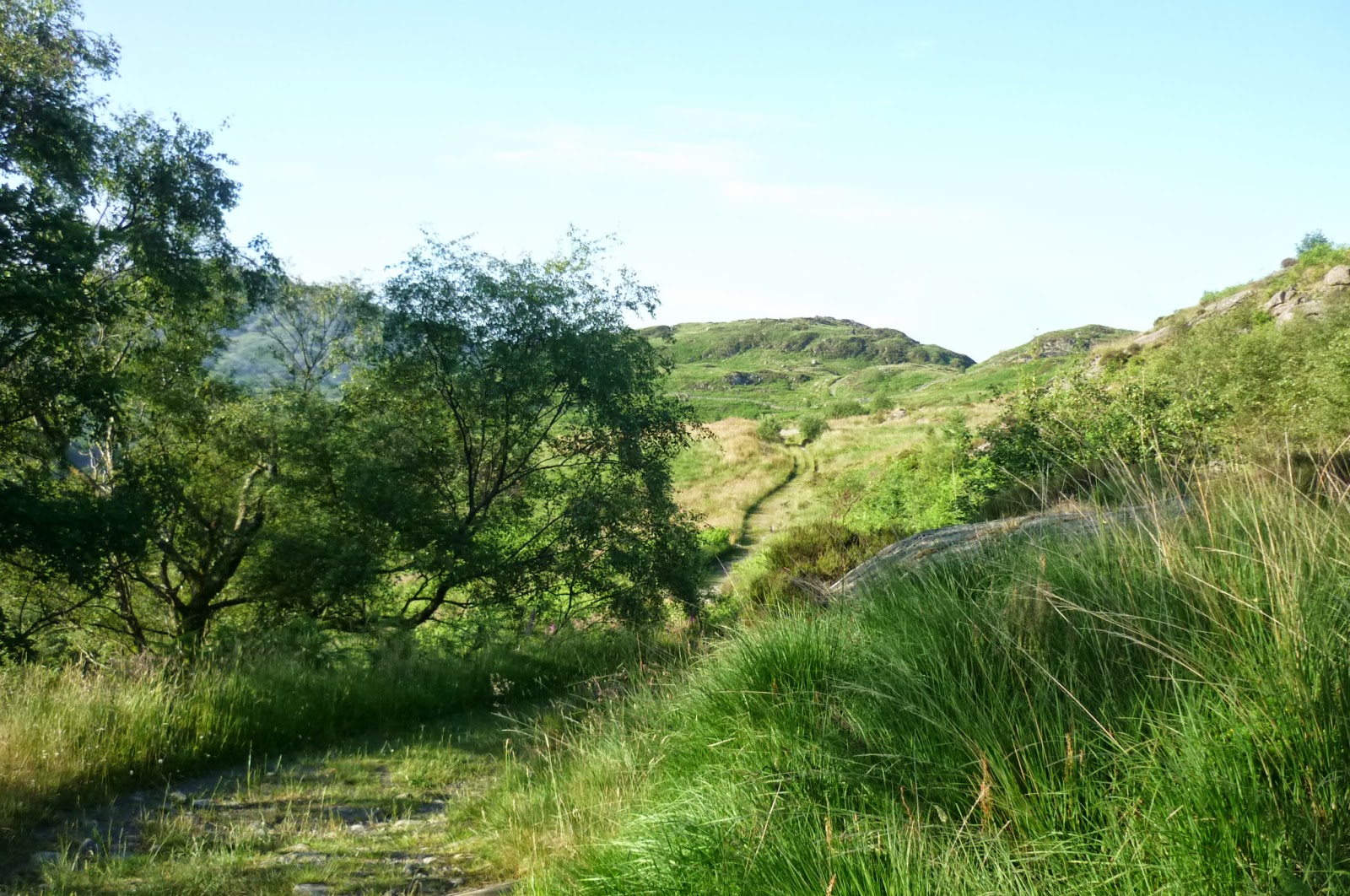
It was as well that I stopped where I did yesterday as there would have been nowhere else to pitch for several miles. There was early cloud but the sun burnt it off after a while. The path skirted the lower slope south west of Harter Fell. There was some bogginess here; had there been recent rain, it would not have been nice. Just after Grassguards, the fenced off plantation with young birch and oak through which the path went was delightful. It was fenced and gated to keep sheep and deer out.


The walk down to Wallowbarrow was lovely but it was here that I took a wrong turn, taking the farm road out rather than a path heading east to Seathwaite. I just hadn't looked at the map. It wasn't until I'd gone about a mile that I saw a phone box where one shouldn't have been that I saw what I'd done. It was a mile along another road into Seathwaite.
Out of Seathwaite, I could see Walna Scar rearing up ahead of me. There was only one way to go and that was up. It was a well used stony track and up, up it went to around 2000 feet. It was a long slog but the vista from the saddle at the top made it worthwhile. The view from where I'd come from was stunning, Seathwaite Fells in the foreground and Sellafield and the sea beyond and ahead of me in the valley below was Coniston Water.


In Coniston, I dived into The Sun for a glass of water and a pint of delicious cider, Addlestones Cloudy. I had a little trouble finding my route out of Coniston but, once I did, it was a good path through Tarn Hows Wood and then Tarn How's itself. The place must be heaving with visitors at weekends but at 5 o'clock on a Monday it was fine. I'd been there before when walking the Cumbria Way in about 2001.


So far, I'm very impressed with the North of England Way. There are no waymarks, of course, but the paths have all been good.
Sent from my BlackBerry® smartphone
Miles walked 16.5 (not counting 2 miles when I took a wrong turn)
Miles left 172
Walking from 6.00am to 8.15pm
It was as well that I stopped where I did yesterday as there would have been nowhere else to pitch for several miles. There was early cloud but the sun burnt it off after a while. The path skirted the lower slope south west of Harter Fell. There was some bogginess here; had there been recent rain, it would not have been nice. Just after Grassguards, the fenced off plantation with young birch and oak through which the path went was delightful. It was fenced and gated to keep sheep and deer out.
The walk down to Wallowbarrow was lovely but it was here that I took a wrong turn, taking the farm road out rather than a path heading east to Seathwaite. I just hadn't looked at the map. It wasn't until I'd gone about a mile that I saw a phone box where one shouldn't have been that I saw what I'd done. It was a mile along another road into Seathwaite.
Out of Seathwaite, I could see Walna Scar rearing up ahead of me. There was only one way to go and that was up. It was a well used stony track and up, up it went to around 2000 feet. It was a long slog but the vista from the saddle at the top made it worthwhile. The view from where I'd come from was stunning, Seathwaite Fells in the foreground and Sellafield and the sea beyond and ahead of me in the valley below was Coniston Water.
Walna Scar -looking back
Walna Scar - looking ahead
The descent to Coniston was easy most of the way. In Coniston, I dived into The Sun for a glass of water and a pint of delicious cider, Addlestones Cloudy. I had a little trouble finding my route out of Coniston but, once I did, it was a good path through Tarn Hows Wood and then Tarn How's itself. The place must be heaving with visitors at weekends but at 5 o'clock on a Monday it was fine. I'd been there before when walking the Cumbria Way in about 2001.
Tarn Hows
Crossing the A593, instead of tarmac walking the lane to Colwith, there was a bridleway through Colwith Wood that wasn't marked on the map. It cut a corner and brought me out on a lane on the far side where I took the path for a mile into Skelwith Bridge. I had been planning to wild camp at Loughrigg Tarn. It looked possible on the map but couldn't be done at all discreetly. I'm in a wood within sight of the tarn and haven't been disturbed. So far, I'm very impressed with the North of England Way. There are no waymarks, of course, but the paths have all been good.
Sent from my BlackBerry® smartphone
North of England Way Day 1 Sunday 22 June
Ravenglass to Spothow Gill GR204002
Miles walked 11.5
Miles left 188.5
Walking from 11.15am to 8.15pm
Today started sunny and warm and was going to stay that way. I didn't get off to an early start. The support vehicle (camper van) needed to be refuelled. Left Ravenglass at 11.15am. Passing by the Roman Bath House (what's left of it) the Way went up a vehicle track and up through a small conifer plantation, over a stile and then across open pasture to the grounds of Muncaster Castle.

Brand new Dirty Girl gaiters on their first outing
The walk directions in the book were clear but I lost the path a couple of times around Hooker Crag. The first five miles followed the Lakeland to Lindisfarne walk in 2008 but none of it seemed familiar. I didn't even recognise where we pitched the first night. We started walking late afternoon and pitched somewhere on Muncaster Fell. I'd marked on the map the point where the 2008 route diverted north but that didn't look familiar either. Oh well. Having said that, the hike to Lindisfarne is one I'd very much like to repeat although I could do without the 36 hours of continuous rain in Northumberland!
Passed by Ross's Camp, marked by a stone slab dated 1883. Seems he was an agent for the Muncaster estate. The slab was intended as a luncheon table.


On and off during the day, there was the sound of the steam engines of the Ravenglass and Eskdale Railway (known as Ratty). The walking for much of the day wasn't too strenuous and I'd thought how nice a pot of tea would be at the café at Dalegarth Station. However, even though it was in sight, I was waylaid by the Brooke House Inn just outside the village of Boot so I fell in and enjoyed a very good pint and some crisps.
After Boot, I faffed about a little trying to find a bit of the path. It was hiding behind a little gate and then went over a wall. Then a short road walk and over a high arched stone bridge and a track leading to Penny Hill Farm. After that, the path climbed and the one I wanted to Harter Fell wasn't easy to find.
I took a wrong one at first. There is actually a stubby wooden sign but I had to trace the words Harter Fell with my fingers to be sure. Even then, the path wasn't clear on the ground although it improved after a while. I crossed two becks and at 8.15 stopped by the second one (Spothow Gill) to pitch but there were midges. I'm a little higher up now. A few midges but there's a light breeze now and then which helps. Just me and the sheep tonight.

Sent from my BlackBerry® smartphone
Friday 20 June 2014
North of England Way
Life is a bit of a tumble at the moment. Having completed the South Downs Way only recently and not having got round to uploading all the photos, I'm off to walk the North of England Way from Ravenglass to Scarborough. According to my mapping, it's about 200 miles and there's nearly 25,000 feet of ascent overall. The walk is from a book by David Maughan. It was devised to use youth hostels but many of them have since closed. It looks to be a good route, though, and largely overshadowed by Wainwright's Coast to Coast. I shouldn't bump into too many other hikers. There should be some good wild camps. All preparations have been made and food parcels put together. I shall be blogging as I go, as usual.
Saturday 7 June 2014
South Downs Way Day 7 Tuesday 3 June
Miles walked 2.
I was away by 6.15am. It was quite foggy and the Way was quite unclear at times which surprised me. Still, as long as I vaguely kept the cliff edge on my right, I wasn't going to go far wrong. A poignant sight - a few simple wooden crosses close to the cliff edge at Beachy Head. Shortly after, I picked up a wide grassy path which slowly descended into the outskirts of Eastbourne where the SDW came to an end. As the Way doesn't go further than this, I felt no guilt at getting a bus into the town centre.

I was away by 6.15am. It was quite foggy and the Way was quite unclear at times which surprised me. Still, as long as I vaguely kept the cliff edge on my right, I wasn't going to go far wrong. A poignant sight - a few simple wooden crosses close to the cliff edge at Beachy Head. Shortly after, I picked up a wide grassy path which slowly descended into the outskirts of Eastbourne where the SDW came to an end. As the Way doesn't go further than this, I felt no guilt at getting a bus into the town centre.
South Downs Way Day 6 Monday 2 June
Miles walked 18.
Had a cooked breakfast this morning and staggered on my way at 8.10am. It was going to be another very warm day. Passing the new YH at Itford Farm, there followed a long, steady climb up to Beddingham Hill, followed by Firle Beacon. The weekend being over, there were very few people about. I stopped to pass the time of day with a horse rider. Elevenses was had near the Bopeep car park. I took my time here as I don't want to reach Eastbourne until tomorrow morning. Dropping down into Alfriston at lunchtime, I shopped for lunch at the excellent deli at the post office. Well worth a visit. I bought a couple of ciabatta rolls, Sussex Camembert and some dry cured ham. Alfriston looked well worth a return visit. I stopped for lunch a mile or so south of the village.

The Seven Sisters made for an exhilarating roller coaster walk. It was a beautiful summer's evening, crystal clear with a clear blue sky. Shortly after six, I stopped in one of the grassy dips to cook. I took my time and thought that where I was couldn't be bettered as a wild pitch. I was out of sight of any habitation and it was completely flat. I nearly unpacked my tarp but realised that I still had a couple of hours of daylight left so reluctantly pushed on.


I passed by Birling Gap, followed by a lighthouse which, for a moment, I thought was manned. In fact, it has been converted into a home and there were people sitting in the glass room at the top. On the nearby road, the car belonging to the Beachy Head Chaplaincy Team passed by twice. I pitched at 8.30pm in a dip just south of Hodcombe Farm. A couple of joggers went by. I'd seen a fox a few minutes earlier on the cliff top but now there were just me and the rabbits.

Had a cooked breakfast this morning and staggered on my way at 8.10am. It was going to be another very warm day. Passing the new YH at Itford Farm, there followed a long, steady climb up to Beddingham Hill, followed by Firle Beacon. The weekend being over, there were very few people about. I stopped to pass the time of day with a horse rider. Elevenses was had near the Bopeep car park. I took my time here as I don't want to reach Eastbourne until tomorrow morning. Dropping down into Alfriston at lunchtime, I shopped for lunch at the excellent deli at the post office. Well worth a visit. I bought a couple of ciabatta rolls, Sussex Camembert and some dry cured ham. Alfriston looked well worth a return visit. I stopped for lunch a mile or so south of the village.
Walking through Friston Forest was cooling. I stopped to look around the visitor centre at Exceat and filled up with water. Then on into the Seven Sisters Country Park which took me up to the coast by Cuckmere Haven.
The Seven Sisters made for an exhilarating roller coaster walk. It was a beautiful summer's evening, crystal clear with a clear blue sky. Shortly after six, I stopped in one of the grassy dips to cook. I took my time and thought that where I was couldn't be bettered as a wild pitch. I was out of sight of any habitation and it was completely flat. I nearly unpacked my tarp but realised that I still had a couple of hours of daylight left so reluctantly pushed on.
I passed by Birling Gap, followed by a lighthouse which, for a moment, I thought was manned. In fact, it has been converted into a home and there were people sitting in the glass room at the top. On the nearby road, the car belonging to the Beachy Head Chaplaincy Team passed by twice. I pitched at 8.30pm in a dip just south of Hodcombe Farm. A couple of joggers went by. I'd seen a fox a few minutes earlier on the cliff top but now there were just me and the rabbits.
Sunday 1 June 2014
South Downs Way Day 5 Sunday 1 June
Miles walked 15.
Was away at 6.15. Another lovely morning. Rabbits were everywhere. I dropped down to the village of Pyecombe, next to the busy A23 road to Brighton, only a couple of miles to the south. Here there was a petrol station with an M&S shop where I shopped for today's lunch.
There was a long shallow ascent up to the ridge again. Once at the top, there was a broad grassy expanse with great views to north and south. The path led up to Ditchling Beacon. Plenty of joggers and bikers about. At Blackcap, I stopped for elevenses and spread the tarp out to dry. Even with the night condensation it is noticeably heavier than when totally dry.


The SDW then turned south over Balmer Down. It then dropped down to the very busy A27 where I took on water at Housedean Farm. Crossing the road by a bridge, the Way led up and round a broad grassy valley with views down towards Lewes. It just hasn't been possible to lose the trail as it is so well marked. Also, as it is used by bikes as well as walkers, none of it is overgrown.


My day has ended at the village of Rodmell, where I am camped in a lady's orchard with a cooked breakfast arranged for 7.30 in the morning. Rodmell's claim to fame is that Virginia Woolf and her husband lived here. I really must read one of her books some time.
Sent from my BlackBerry® smartphone
Was away at 6.15. Another lovely morning. Rabbits were everywhere. I dropped down to the village of Pyecombe, next to the busy A23 road to Brighton, only a couple of miles to the south. Here there was a petrol station with an M&S shop where I shopped for today's lunch.
 |
| Early morning mist over Pyecombe |
The SDW then turned south over Balmer Down. It then dropped down to the very busy A27 where I took on water at Housedean Farm. Crossing the road by a bridge, the Way led up and round a broad grassy valley with views down towards Lewes. It just hasn't been possible to lose the trail as it is so well marked. Also, as it is used by bikes as well as walkers, none of it is overgrown.
My day has ended at the village of Rodmell, where I am camped in a lady's orchard with a cooked breakfast arranged for 7.30 in the morning. Rodmell's claim to fame is that Virginia Woolf and her husband lived here. I really must read one of her books some time.
Sent from my BlackBerry® smartphone
Subscribe to:
Posts (Atom)

