Sunday 30 June 2013

South West Coast Path - Saturday 29 June

Away at 8am with all the signs of a warm day to come. The trail continued along the promenade at Swanage. Quite a few people around including joggers and others setting up beach stalls and also a display by the Royal Corps of Signals. Through New Swanage along residential roads where the trail came inland a little before returning to a cliff top path. The path was clear and well used. Had I wanted to, I would have found pitches for a wild camp at Ballard Down, The Foreland and along the straight stretch towards Studland from Old Harry Rocks. I would have had to have carried water from Swanage though but that wouldn't have been a problem.

Looking back to Swanage

Old Harry Rocks

Old Harry Rocks

At Old Harry Rocks, I was met by arrangement by John Yale and Brian & Jill Toalster, who had walked down from South Haven Point. We then walked together to Joe's Café at Studland where we stopped for refreshments before walking along the beach around Studland Bay. It being a weekend, there were lots of people around. We averted our eyes as we went along the shoreline of the naturist beach. Then it was but a short distance to the ferry at South Haven Point and, for me, the end of this little odyssey and the end of the South West Coast Path which I started in 2001. Thanks John, Brian & Jill for taking the trouble to share your company with me.

At Joe's Cafe

At South Haven Point

Friday 28 June 2013

South West Coast Path - Friday 28 June

It rained all last evening and the cows appeared and made their way over to me. My main concern was that they'd trip over the guys which extend several feet from each end of the tarp but they didn't. They snorted and breathed heavily around me for a bit, ate a bit of grass and then moved away.

This morning I was away by 5.30. The last steep ascent of the path was just a few feet into today's walk. The chapel at St. Aldhelm's Head was open (literally - even the door was open) so I had a look around inside.


Tilly Whim Caves (closed since 1976)
The path for few miles to Durlston Head was easy enough but much of it was surfaced with a fine tilth which, because of the rain, accumulated on my shoes in great clumps. Then it was a good path into Swanage. First stop the library for thirty minutes on a computer which enabled me to put a bit of charge on the phone. Then to the YH where I was able to reserve a bed in a dorm for after 2pm. I was very hungry by this time and gorged on possibly the best fish and chips ever at the Fish Plaice followed by a pint of Piddle at the White Swan (where they offer free phone charging while you're there). One of those amazing coincidences then happened. Friends Robin and Faith from Bristol came in for lunch, having come in to Swanage on the steam train from Norden. We hadn't known the other(s) were going to be anywhere near Swanage, let alone that pub at that particular time.

Now back at the YH with some healthy food for later and tomorrow. Had a first shower for a week. My shoes are outside the dorm room. They don't smell nice.

View from YH dorm window
Sent from my BlackBerry® smartphone

South West Coast Path - Thursday 27 June

Away at 6.25am. I have a double diversion today. One to go round the military firing range and the other to avoid a 5km stretch of the Coast Path that is closed due to landslips. My overnight pitch was on the Purbeck Way. I had part of the firing range diversion on my printed map sheets but not all of it so I was going to rely on the route description and sketch map in the Trailblazer guide. All went well for a while. Things fell apart slightly at SY842831 by a ruined tower gateway on the boundary of Lulworth Castle.
 
 There was a left hand turn on to a clear vehicle track signposted to various local destinations whilst there was a field gate straight ahead with a small sign for a permissive bridleway (which I should have taken) but it wasn't clear, particularly as the clear track to the right (which I took) wasn't shown on the OS map. Anyway, on crossing a road a mile ahead, I was stopped going through Kennel Farm along a permissive bridleway and put right. The friendly farmer even brought out a map to show me where I should be and took a few photos of relevant bits of the map. It was fine after I got back on course. The route took me around the perimeter of the military firing range which was a very nice route. Some muddy bits. No-one around at all.  
 
Creech Grange
With the help of a GPS, I was able to see when I came back on to my map and I walked down to Kimmeridge where I found (as mentioned in the Trailblazer guide) Clavell's Café and Restaurant, a gem of a place. Crab sandwiches, chips and salad, washed down with elderflower pressé.  
 Here I joined the diversion due to the landslip. The whole section between Kimmeridge Bay and Houns-tout Cliff is closed. It was a good inland route, up to the trig point at Swyre Head (where I met coming the other way about 25 members of U3A out for a nine mile walk) and then down to the village of Kingston. Here I got water for the night from a tap outside the church and headed south to the coast at Chapman's Pool and up to the Coast Path at West Hill. It started to rain and so it was a wet and blustery walk out towards St. Aldhelm's Head. I found a decent pitch at the foot of Emmetts Hill at SY959759. There was evidence of cows but none in sight. Plenty of cow pats but I managed to pitch in between them.


Sent from my BlackBerry® smartphone


Wednesday 26 June 2013

South West Coast Path - Wednesday 26 June

 
 A bit of a chilly morning to start. I woke at 5 and was away by 6. As I'm ahead of schedule, I knew I could have a short day and had in mind heading for the Youth Hostel at West Lulworth, about 9 miles distant. Lots of rabbits about as usual. Passing through Osmington Mills, I snuck into the campsite for water. It looked a fine site but all of them around here seem so expensive (although I could do with a shower). Shortly after, I stopped by the path to brew coffee and have breakfast.


On then to Ringstead where I came across a wooden shack shop in the car park which sold hot and cold food and drinks (not mentioned in the Trailblazer guide). A mug of tea and an egg and bacon roll went down well. Here I met Andy Millard from Weymouth who was out for a couple of days along the Coast Path, camping. A friend of his is a Backpackers Club member and he showed interest in joining. He said to avoid the campsite at Durdle Door as the crows are very noisy. The Trailblazer book says, "You'll understand why a collection of crows is called a murder, because that's exactly what you'll want to do with them at 5am when they wake up".
 The trail started to get quite strenuous, and continued that way for a couple of miles. The views each way were glorious and it became very warm.


The foot of the steep dip by Swyre Head is called Scratchy Bottom and the signpost with this on is much photographed (yes, I did).  After another long ascent, the view ahead got even better, looking down on Durdle Door, St. Oswald's Bay and then Lulworth Cove. The area is very popular, as evidenced by the number of holidaymakers.


 I snoozed for a while overlooking the Cove and then made my way to the YH at West Lulworth. It was closed until 5pm but I was able to leave my pack there and headed off into the village. The pub was closed but an excellent pint was had at the Royal British Legion. On returning to the YH I was told it was fully booked by a school party. When asked why a notice to this effect hadn't been on display, there was no answer. Not impressed.
I'm now camped in a corner of a field a short way north of West Lulworth. As the firing range is in use, I'm taking an alternative route away from the coast.
      

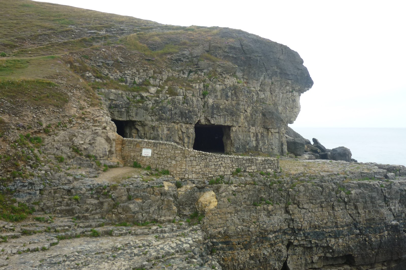
I make no apology for the number of photos. The scenery along this coast is simply stunning (and the weather helped).
Sent from my BlackBerry® smartphone


Tuesday 25 June 2013

South West Coast Path - Tuesday 25 June

 
 Now if I woke at 4am at home to answer a call of nature, I'd stagger back to bed. Not today, though. I started packing up in the dawn. The moon was still bright. Away by 5. I hadn't realised there was a camp site in the next field. I still wouldn't have stayed there but I filled a water bottle as I went by. No-one was around. The path closely followed the East Fleet to Ferrybridge.

Half a man poking out of the water (at Ferrybridge)
I walked the two miles over the causeway (known as the tombolo) to Portland and stocked up with food for the day in Fortuneswell. It was a steep climb up to the coast path on the west side of the island.

Fortuneswell
A path diversion took me through a former quarry, now a sculpture park. It was a good diversion.


Rejoining the path, it was a grassy track most of the way to Portland Bill.


The weather got quite hot so mid morning I stopped and put the tarp up to dry. I had a welcome pot of tea at the Lobster Pot Café.


 Moving on a short way, I passed a large number of wooden sheds/chalets which seem to be very popular here. I had seen one for sale in an estate agent's window earlier for £30,000.  
Yours for £30,000
I stopped for lunch on the rocky beach at Church Ope Cove - more sheds here. The colour of the sea and the rock strewn landscape was very reminiscent of southern Europe.  


Church Ope Cove

 The path then went inland, past the YOI and then HM Prison The Verne before dropping down to Castletown. I didn't feel it was cheating to get the bus across the tombolo to Ferrybridge.
Looking from Portland to Weymouth
The walk around Portland Harbour to Weymouth was quite pleasant and I was very impressed with the centre of Weymouth, which was busy. Lots of tempting pubs and restaurants. I think Olympics money was lavished on the place in 2012. Then all along the promenade looking out to sea at Weymouth Bay. At Overscombe, I met a lady and her elderly mother having a drink on the terrace of their holiday apartment. I asked for my water bottle to be filled and was treated to some unexpected trail magic - a bottle of cider. We chatted for a while and I then moved on to sort out a pitch for the night. I'm on the edge of a large pasture area overlooking Weymouth Bay. The area is criss crossed with paths. All the people out walking up here have now gone. Twenty miles walked. I've now covered about sixty miles with only forty to go. I shall take it easy a bit.


Sent from my BlackBerry® smartphone


Monday 24 June 2013

South West Coast Path - Monday 24 June

I think I may have saved a life today. I emerged from the tarp just after 5am and close by was a fox and a pheasant. On seeing me, the fox legged it, leaving the lucky pheasant blissfully unaware of its good fortune. I was away by 5.45 and within minutes was ascending Golden Cap, at 191 meters, apparently the highest point on the south coast. It certainly got the blood moving.


Golden Cap
The view east from Golden Cap
Then down to Seatown, where I stopped to chat to a man who is a carpenter and does work for the National Trust, making wooden signs and he has also made a large dresser that is in use at Montecute House. He was carrying a gun and was pleased to have ended the career of a fox that had killed up to eight lambs.

Seatown
The views each way along the coast were stunning and far reaching and remained so for much of the day. On then to West Bay, the setting for some of the scenes in Broadchurch. The Trailblazer guide recommended Ellipse, an Italian bistro (which also featured in Broadchurch) where I had some excellent coffee and a full English which set me up for the day. It was actually my second breakfast.

East Cliff, West bay
Looking back to West Bay
West Bay is nothing but a resort, packed with fish and chip and similar eateries but I rather liked it. The next few miles were flat and undemanding towards Abbotsbury. Passing by the Swannery, I began to think about a wild camp later on. The loos at the Swannery are to be recommended for water and posh pink liquid soap. I found that a Dyson Blade hand drier is no good for the face. Even though it was only mid afternoon, with water on board, I knew that I could pitch later wherever I wanted. 


At 7pm I stopped and cooked a meal as an energy boost. I felt pretty sure of finding a pitch and then a couple of good sites appeared but then I found the perfect one. A few dog walkers have passed by but, apart from some cows in the adjoining field, there's just birdsong. Walked 19 miles today. Tomorrow is Portland and Weymouth, which, with an early start, shouldn't be too bad.

East Fleet
Sent from my BlackBerry® smartphone