Thursday 30 April 2009

Day 26 Thursday - Lichfield to Rugeley

Walking 8.30am to 11.20am
Distance walked today 7 miles
Total distance walked 383 miles
Distance left 669 miles

The farm dog, a collie, was daft and my friend for life but when I returned from the washroom this morning, she was lying outside the tarp eating something. She'd managed to root out my effervescent vitamin C tablets that I'd mislaid. They'll probably cause her to foam at the mouth and, whilst I may catch a cold, she certainly won't.

I joined the footpath at the back of the farm, going by Tomhay Wood and Vicar's Coppice. I then dropped down to the Trent & Mersey Canal. By cutting across to Fullbrook Farm yesterday, I'd missed Fradley Junction where the Coventry Canal meets the Trent & Mersey. Although there's a caravan site at Fradley Junction, it seems to be one of those 5* sites that doesn't take campers.

The T&M was very pleasant although it came on to rain after a while, but not heavy. Approaching Rugeley, I found myself on The Way for the Millennium (different from the Millennium Way of a few days ago).

I'm now going "off trail" but will be back on Saturday morning so don't go away. I heard yesterday that Reg and Geert were at Cannock.

Day 25 Wednesday - Kingsbury Water Park to Lichfield

Walking 9.10am to 4.30pm
Distance walked today 13 miles
Total distance walked 376 miles
Distance left 676 miles

I woke in the early hours and it was a moment or two before I realised that the continuous noise was traffic on the nearby M42; it never stops.

I tried Vinnie's pack on to test the weight. He's carrying only 14lbs! His pack is a Golite Breeze (I used one in 2004 for my Italian trip - http://litehiker-italianjourney.blogspot.com/) but he really is travelling ultralite - no stove or food. He uses a Mont-Bell one man tent.


Vinnie and I walked together today. We joined the Heart of England Way which followed the route of the canal alongside the site, the Birmingham & Fazeley. The weather was perfect and stayed fine all day. I'm told rain is forecast for tonight.

It was very pleasant walking as the canal here is attractive and time passed quickly as we talked and walked. We were at Fazeley Junction by 11am where we turned west, continuing along the Birmingham & Fazeley Canal (east was the Coventry Canal). At 12.15 we called in at a canal-side pub at Hopwas and had pints of bitter shandy - Vinnie hadn't had shandy before and gave it his seal of approval. A short distance later we stopped to talk to a couple sitting on a bench; the wife gave me a £3.00 donation.

At 2.30, Vinnie left to go into Lichfield, probably to find a B&B and take a day off tomorrow. I expect we might meet up again in the Peak District or on the Pennine Way. I went on to locate my campsite at Fullbrook Farm, a mile north of Lichfield. On the way, I came across some waymarks for the Erasmus Darwin Walk, presumably a local route.

Now, anglers are renowned for ignoring both canal boaters and hikers but I managed to engage one in conversation. The reason was probably that today marked his return to fishing after a break of twenty years. He was laid off by LDV, the van manufacturer last December and had only just heard today that they've gone into receivership. He may be spending more time fishing in the future than he would like.

The charge for me to camp at Fullbrook Farm was £4.00 but I was given £2.00 back as a donation which was really nice.

Wednesday 29 April 2009

Day 24 Tuesday - Baddesley Clinton to Kingsbury Water Park

Walking 7.50am to 6.05pm
Distance walked today 20 miles
Total distance walked 363
Distance left 689 miles
David dropped me back at Baddesley Clinton on his way to work. The Heart of England Way was a little tricky to find - through a little housing development and then round the back of some lock-up garages but then it was into woodland and open country immediately. It was pleasant enough and easy to follow, being well waymarked. At times, the route was shared with the Millennium Way, the Centenary Way and the Mary Arden Way (which seems maybe to be a "sub way" of the Heart of England Way).
At Berkswell, I went into the church as there was such a welcoming sign outside. There is a well-restored crypt beneath the church which I went down to. Whilst in the village, I bought some Berkswell cheese, made in the village from ewes' milk - very nice.
Yet another "way" was also encountered but this one was called "A Coventry Way" ("A", not "The"). It's a 40 mile circular route around Coventry.
Although Meriden was on my schedule for camping tonight, I thought I would get to it too early and this proved to be the case - stopping for the day at midday is ridiculous. I thought maybe a few miles more to Shustoke would just about do it - there's a pub there and the reservoir. Anyway, shortly after I crossed over the M6, I entered a field with the usual crowd of young bullocks crowded against the stile into a field. I knew what to expect and, true to form, they came after me. I held them back every few seconds, shouting and waving my walking poles but the end result was that I didn't check the map or see that my intended exit was across to the far corner of the field. Inevitably, I clambered over the first available gate and there was then no legitimate way out of where I found myself, which was directly in front of a farmhouse. I then headed down the driveway towards a road and was hailed by an elderly lady from a window who gave me an ear-bashing, thinking I was a Rambler - I put her right on that count but obviously others have had a similar experience recently with the bullocks and ended up where I did.
Anyway, I eventually had lunch and, looking at the map, realised that I might manage the distance to the site at Kingsbury Water Park. Therefore, I power-walked the last six miles or so, (startling an Alsatian in a wood where its master was photographing bluebells. He called it off me) arriving at the site just after 6pm when it was just starting to rain.
Along the approach road to the site, a guy coming towards me looked closely at me and said, "Do I know you? Are you Litehiker?" He was the American I'd heard about some days ago. He's Vinnie (Vincenzo) from New York State and had been reading this blog back home before he left the US. He's also familiar with many of the other UK bloggers. He's heading for John o'Groats as well.

We've been down to the pub to get acquainted and plan to walk together tomorrow.

Monday 27 April 2009

Day 23 Monday - Stratford-upon-Avon to Baddesley Clinton

Walking 10.15am to 4.15pm
Distance walked today 14 miles
Total distance walked 343 miles
Distance left 709 miles

By special request, I'm now including the total distance walked so far from Land's End. Also, my support team has adjusted the mileages in my schedule and ascertained that the total distance from Land's End to John o'Groats is 1,052 miles and not the 1,075 that I had originally calculated. So, 709 miles to go. By my reckoning, I've covered 32.6% of the distance, nearly one third.

I've worn through the original pair of rubber boots on my Pacerpoles so a visit to Millets today was made to buy the two pairs they had available.

I joined the Stratford-upon-Avon Canal at the basin in Stratford. Amanda joined me for a short distance before heading for home. Shortly after, I was joined by Richard, on a regular walk from Stratford to Wilmcote, three miles up the towpath. He was good company. He was, until recently, the manager of Mary Arden's House at Wilmcote and was walking there today. His wife is the archivist of the RSC.


Bridge near Wilmcote


Bearley aqueduct


I continued along the towpath from Wilmcote. It was raining on and off all day but not too hard and it wasn't actually unpleasant rain. The Stratford is one of my favourite canals. I went over three aqueducts, the Edstone at Bearley Cross, the one over the road at Wootton Wawen and the Yarningale. Apart from these, the canal's architecture is interesting. The design of the bridge shown below is peculiar to this canal, having a metal span with a gap in the middle. This allowed the original horse-drawn boats to pass through without unhitching the horses. Also, some of the lockkeepers' cottages have barrel roofs; these only feature on this canal.


Lowsonford

I passed under the M40 and left the canal at Kingswood Junction, following field paths to the entrance to the National Trust's house at Baddesley Clinton and then walking on to the A4141 at Chadwick End where I was picked up by David and brought back to Stratford. I shall be dropped back there tomorrow morning. David and Jane are brilliant friends.

Sunday 26 April 2009

Day 22 Sunday - Broadway Tower to Stratford-upon-Avon

Walking 6.15am to 4.00pm
Distance walked 17 miles
Distance left 739 miles

I had thought that maybe the car parking area behind me at the restaurant might have been used at night by trysting couples or drug dealers doing deals but, in fact, there were no goings on and I spent a peaceful night. I got off to an early start as I was meeting the family for a picnic lunch at one o'clock. It was a misty moisty morning and I saw plenty of red deer in the area around Broadway Tower.


Broadway Tower

Even if I hadn't camped at the restaurant, with water I would have found any number of camping possibilities in the next three miles or so. There is the Fish Hill picnic area where the loos appeared to have been open all night and there is an outside water tap. The Mile Drive, just a bit further on would have been very suitable as well.

I bypassed Dovers Hill just before Chipping Campden. I've been there before and there would have been no views this morning. Campden was very quiet. I went into a shop and bought some of my favourite Cadbury's Fruit & Nut and was tempted by a real bargain at the till. Snickers are the usual bars I go for at 55p each. I bought a pack of five reduced to 99p, presumably as they were at or past their sell-by date.

Having been used to obvious signs for the Cotswold Way, I realised that I was now switching to the Heart of England Way and struggled a little to find where to join it. In fact, the first sign for it I found was in a side road just behind (north of) the church. Most of today, it has been indicated simply by little sticky labels on existing footpath signs.

I went through Baker's Hill Wood above Mickleton. Lots of bluebells. I took a photo but seem to have difficulty in capturing the magical blueness of them.

Bakers Hill Wood
From Mickleton, it was pleasant walking through Upper and Lower Quinton. I then left my planned route to meet Amanda and other parts of the family at Preston-on-Stour where we enjoyed a picnic on the village green. Granddaughter Kezia celebrated her first birthday yesterday. Mike, Philippa and Kezia joined me for the short walk to Atherstone-on-Stour and I then left them to walk on to Stratford through Clifford Chambers (I always think it sounds more like the name of a person than a place).

Today, my route coincided in parts with the Monarch's Way, the Centenary Way and Shakespeare's Way.

I posted yesterday's and the day before's postings together today but had real fun and games trying to do so. Having to use public callboxes with the Pocketmail, the one in Campden was working but didn't work with the Pocketmail, the one in Mickleton was not working properly, in Upper Quinton there was a callbox but no phone in it and I finally succeeded in Lower Quinton. I think maybe a more up to date Pocketmail would work with a mobile phone (mine is supposed to but doesn't).

Day 21 Saturday - Winchcombe to Broadway Tower

Walking 7.35am to 4.00pm
Distance walked 12 miles
Distance left 756 miles

It was raining when I struck camp at 6.45am but everything got packed away under cover of the tarp so no problem. As luck would have it, it had virtually stopped by the time I moved off and it's been a clear, quite sunny day.

I passed Hailes Fruit Farm where camping would have been a possibility had I gone two miles further on last night. The route went alongside Hailes Wood before going uphill through sheep-filled fields and up to an ancient hill fort (marked on the map as Beckbury), past some old farm buildings at Upper Coscombe (where I took a photo of a strange farm building standing on staddlestones).

Upper Coscombe

There was then a gentle descent into Wood Stanway. On the way down, I bade good morning to a couple sitting admiring the view and, in another of those coincidences, realised that I knew them! Larry and Olivia from home. They were walking the Cotswold Way north to south using B&Bs.

Larry and Olivia
I then came into Stanway with its beautiful gatehouse and adjacent church.

Gatehouse and church at Stanway
The village of Stanton came next, pure chocolate box. There was quite a climb to Shenberrow Hill, followed by an elevated track northwards (more beautiful views, now to the Malverns) and then down to Buckland Wood.

It was here that I left the Cotswold Way for today, taking footpaths eastwards by Buckland church and then uphill towards Broadway Tower.
I came to a restaurant/tearoom and was tempted by a cream tea. I recognised the lady running it, Kim, as someone I knew through work some years ago. She was so impressed with my adventure that she brought me another and larger pot of tea and has allowed me to camp here.

This where being quite close to home at this point has its advantages. During today, I noticed that the heels of my boots were coming apart. James, bless him, drove over with my other boots and also a new backup battery for the Pocketmail which threw a serious wobbly last night, hence the lateness of yesterday's posting. I hope it's OK now.

Day 20 Friday - Leckhampton to Winchcombe

Walking 8.45am to 5.30pm
Distance walked 12 miles
Distance left 768 miles

Ian and I shared breakfast this morning. He produced some excellent coffee and some toasted home-made rye bread. Laila being German, this is one thing from home she can't do without.

I set off to meet David through the back roads of Cheltenham, about three miles. He was waiting at the Reservoir Inn when I arrived.

We joined the Cotswold Way just over the road, the path taking us across the end of Dowdeswell Reservoir. It then went uphill through woodland. At some point, I must have missed a CW sign because I realised we were no longer on the CW. However, the bluebell wood we were in was too good not to stay in so I navigated us up to the lane ahead and we rejoined the CW from there.

The way went north with marvellous views over Cheltenham and beyond to the west. David had brought an excellent packed lunch for us both.

We debated whether or not to go round the complete loop of Cleeve Common or to cut across the bottom of the loop to save time. However, the weather was fine and time was on our side. Navigation was a bit difficult at times, though, as someone had thoughtfully removed all the CW roundels!

Belas Knap long barrow was interesting but the entrance had been blocked up. I'm sure that when I last visited it years ago, I was able to go inside, unless my memory is at fault.

Belas Knap
There was then a long and gentle descent into Winchcombe where David's wife, Jane, was waiting for us with a couple of bottles of Old Hooky. A few minutes later, my son, James, turned up with his girlfriend, Lia. David and Jane then left (I'll be seeing them again on Sunday as they are provding a bed for me in Stratford-upon-Avon). The three of us then went in search of the farm a fellow Backpacking Club member had arranged for me to stay on (thank you, Neil).
We then went back into Winchcombe in search of food. The Plaisterers Arms looked about right; the food was good and so was the beer. A good end to a good day.

Friday 24 April 2009

Day 19 Thursday - Nympsfield to Leckhampton

Walking from 6.30am to 6.45pm
Distance walked 21 miles
Distance left 780 miles

I started really early as I knew a long day was ahead. I had hoped to end the day at Witcombe with some fellow Backpacker Club members but they were away walking in Scotland. I therefore made contact with another member, Ian McPherson, in Leckhampton, on the edge of Cheltenham and he confirmed that I could pitch in his garden.

The day started off misty but was forecast to be fair. It has been a day of amazing views, following the edge of the Cotswold escarpment and spending much of the time walking through woodland, which I love doing.

Stanley Woods

I regained the Cotswold Way within half a mile of Nympsfield, skirted Frocester Hill, going through Stanley Woods where I stopped for breakfast and coffee. I then dropped down to go through King's Stanley and Ryeford and climbed again to pass through Standish Woods, then heading west to Haresfield Beacon and then east to go through Stockend Wood before descending into Painswick.


Views from Haresfield Beacon
I stopped for lunch in the churchyard and there met Geert, the Dutchman. He had met up with Reg again. Reg had stopped early in Painswick at a B&B. Geert was going on to camp south of Witcombe Wood (a site I had missed when looking at the map yesterday). Geert went on after a few minutes.

Painswick churchyard
This afternoon's route took me over a golf course outside Painswick and through Pope's Wood. Then, to save some time and distance, I took a lane to Cranham, avoiding the loop round Cooper's Hill, going through Witcombe Wood, emerging from woodland at Barrow Wake, a local viewpoint where the views were stunning, looking towards Gloucester and beyond.

The traffic was very busy at the roundabout at the Air Balloon pub and eventually some very nice drivers let me across the road. Then I entered the Crickley Hill Country Park, following the Cotswold Way around the edge to the northern side where I took an unsigned bridleway down towards Leckhampton. The walk through the better part of Cheltenham was quite pleasant although I was glad of my Pacerpoles to help me stay on my feet! It had been a long day.

Ian and his wife, Laila, have made me very welcome. We have shared a meal together and spent a very enjoyable evening. The tarp is pitched on a very small area of grass - it only just fits.

I shall be walking with David Southeard tomorrow and it will be a much shorter day.

Thursday 23 April 2009

Day 18 Wednesday - Horton to Nympsfield

Walking 8.45am to 5.30pm
Distance walked 17 miles
Distance left 801 miles

I overslept this morning! I woke first at 6.15 but must then have burrowed down into the sleeping bag. When I woke next it was dark and as I emerged to the dazzling light, I saw it was 8 o'clock. I hurriedly got up, packed up and went, without doing the usual morning things.
I stopped after a mile or so, had a quick wash, teeth clean, breakfast and coffee and felt much better for it.
I said to Reg last week when he went off to Tiverton that I'd probably bump into him again on the Cotswold Way and so it proved to be. Just south of Hawkesbury Upton, I came across him and Geert, the Dutchman. I think they'd been together a day or so, having both stayed at Bath Youth Hostel. Whilst Reg is B&Bing every night, Geert is B&Bing and camping.
The three of us then walked together a couple miles into Hillesley. In the meantime, Robin had rung to say he'd arrived in Wotton-under-Edge. He walked out to meet me. I left the other two there. Reg was going on to a B&B in Dursley and Geert was heading towards Tewkesbury, both to separately follow the Severn Valley Way. I may see them again in the Peak District or on the Pennine Way. They had heard that there is an American about a day ahead of us going to John o'Groats.
Robin and I walked through Wotton-under-Edge, a place to visit again some time; it looked very interesting. We stopped for the picnic lunch he'd brought at Brackenbury Ditches, a hill fort, with far-reaching views to the south and west. Robin had brought filled rolls, Danish pastries and "lashings of ginger beer" - what a star.

We walked on to Nibley Knoll, a monument to William Tyndale, known for having translated the Bible into English and later burnt at the stake for his views.
Two old gits
Robin left me shortly after to return home and I went on through Dursley, across some fields (where I saw a fox) and then climbing steeply up to the Cotswold enscarpment. I then went through Coaley Wood, emerging after another long climb close to the road turning to Nympsfield. I headed for the Rose & Crown which I understood did camping. It has recently changed hands and I am their first camper, in a paddock at the back.

I can confirm that campers are welcome and there is no charge. However, there are no facilities, although the loos can be used during opening hours. The beer is excellent - there is a choice of Uley Bitter (brewed in the next village), Butcombe and Doom Bar, together also with Uley Pig's Ear, a stronger beer at 5%.

Wednesday 22 April 2009

Day 17 Tuesday - Saltford to Horton

Walking 9.10am to 6.30pm
Distance walked 17 miles
Distance left 818 miles

John walked with me for the first seven miles. We called in to see a friend of mine, Murray, at Kelston. A quick chat and a cup of coffee and we were on our way again.

We picked up the Cotswold Way shortly after, having diverted briefly to go via Kelston Round Hill. At Prospect Stile, we found someone waiting on the other side. He asked if we were going far. I replied that I was on my way to John o'Groats. He responded, "You must be Geoff then". I didn't deny it. He was Don Ray. He had been following this blog and so knew I would be coming this way. He did John o'Groats to Land's End in 1999 and is a TGO Challenger. Don walked with us until the monument commemorating Sir Bevill Grenvile, Civil War/Battle of Lansdowne commander. His car was parked there. Thank you Don for taking the trouble. We enjoyed your company.


John and I continued to the pub at Cold Ashton on the A420 where we had a pint of Wadworths 6X and a bite to eat. Philippa collected him from there. It was a really enjoyable morning with excellent company.

I went on alone, cutting across to Pennsylvania, then passing through Dyrham, an idyllic Cotswold village. The view of the house at Dyrham Park from the road was impressive.

Dyrham Park

I continued, passing over the M4 through Tormarton and then Dodington Park, now owned apparently by Sir James Dyson, designer of vacuum cleaners.

I then descended into Old Sodbury, beginning to think about finding somewhere to camp. I went on, passing through a large hill fort. I am now camped on a farm at Horton where the Cotswold Way follows the same route as the Monarch's Way. The couple in the adjacent caravan were very friendly and intrigued by the Pocketmail.

The weather today has been perfect. Clear blue skies and sunshine, very warm but not too hot. It is set to continue. The scenery has been the Cotswolds at its glorious best.

I've arranged to walk some of tomorrow with Robin Davey, probably meeting at Wotton-under-Edge.

Monday 20 April 2009

Day 16 Monday - Butcombe to Saltford

Walking 10.00am to 4.30pm
Distance walked 12 miles
Distance left 835 miles

The weather today was as forecast - bright and sunny and quite hot at times. I was sent on my way with a full English and plenty of good coffee. Margaret walked with me for the first mile or so but then her short little legs thought they should be returning home.

I diverted from my planned road route to Chew Magna and took field paths instead, a good decision. In fact, the whole day's walking was well signposted. I hadn't been to Chew Magna for years. It's a large village that shouts, "prosperous"; a good number of large village houses and well-restored cottages. It even boasts a full-time NatWest bank and two estate agents.

I then went through Stanton Drew and visited briefly the famous stone circle.


I recall that the story behind this is that locals were dancing there on a Sunday and were turned to stone by the Devil. I stopped for lunch just before reaching Stanton Drew and then realised that I'd got a good mileage to do to get me to day's end at Saltford so I spent the whole afternoon really charging along, mainly along well signed field paths, which made for very enjoyable walking. The countryside around here is very beautiful. The path took me through some really beautiful woodland carpeted with bluebells.


I then passed through Pensford, Publow, Woollard and Compton Dando before steaming into Saltford. I found John and Philippa's home relatively easily; I haven't seen them for many years (this trip is proving a great opportunity to catch up with old friends). John and I shared a flat in Bristol for a while in another lifetime.

John and I adjourned to the Jolly Sailor for a couple of pints of Butcombe and reminiscences while Philippa slaved in the kitchen (nothing changes!) and a superb meal awaited us - the chocolate and ginger slump cake was memorable.

Sunday 19 April 2009

Day 15 Sunday - Rodney Stoke to Butcombe

Walking 7.40am to 1.15pm
Distance walked 10 miles
Distance left 847 miles

The night went from being calm to quite windy so had to go out to re-peg it down to the ground all round - the sides had been off the ground to give more space and airiness but this setup doesn't suit windiness.

I got off to an early start. The morning was quite chilly and breezy but with the promise of later sunshine. I followed the main A371 through Draycott andten took a minor road to Bradley Cross and then footpaths steadily climbing through woodland and then pasture over Cheddar Cliffs to Black Rock. Crossing the road at the head of Cheddar Gorge I entered into the woodland on the other side. I met there a backpacker. He was doing a week of the Southern Coast to Coast, Weston-Super-Mare to Dover. He'd done LEJOG in 1995.

Beyond was what could pass for a typical Derbyshire Dale. This then led to open pasture with the regular reports of a clay pigeon shoot.

I passed just to the east of Beacon Batch where I encountered some unexpected bogginess. I stopped to pass the time of day with some mountain bikers who are planning a trip cycling north to south in Ireland.

I then descended into Blagdon. The views over Blagdon Lake and beyond were stunning, it now being a hot summer's day.


Views of Blagdon Lake

I followed the lakeside path on the northern shore and made my way up to Butcombe along field paths to spend the day with wife, Amanda, sister Margaret and brother-in-law, Dick. Lunch and cold beers on the terrace and a full-scale roast this evening. I shall need a walk tomorrow to shed the weight gained! I suggested sleeping under the tarp tonight but have been persuaded to sleep in a bed.

Day 14 Saturday - Westonzoyland to Rodney Stoke

Walking 8.10am to 4.55pm
Distance walked 15 miles
Distance left 857 miles

I cut through from the back of the site to my intended footpath this morning and even found a section of fence where the top strand of barbed wire was missing. A nice start to the day.

The path was well waymarked and I found the bridge over King's Sedgemoor Drain without difficulty. It was a very tranquil scene. I took a photo as a swan began to swim across.

I went through the village of Sutton Mallet. The hill up to it was my first for a while or so it seemed.
The path through the small patch of woodland on the approach to the A39 south of Catcott was not at all as shown on the map. I had to unload to climb over a barbed wire fence out of the wood into a field. There was a stile but not all where it should have been according to the map.

I went through Catcott and then took the track around the back of Canada Farm. This made delightful walking through the Shapwick Heath Nature Reserve. There was then a stretch of road walking into Westhay where I stopped for a pint at the village pub, a very unpretentious place. A gamekeeper was talking about how good his dog, a brown and white spaniel, was at retrieving rabbits and pheasant and a couple of old boys were talking about, "putt'n the taters in tomorrer".

I then entered the Avalon Marshes, with reedbeds and areas of water which is home to migrating birds. There is a visitors'centre. The area is full of history. I had lunch in a large hide looking out over the water and reedbeds. There were lots of swans around and a couple of grey heron but not much else.

My newly devised route took me through the village of Theale, along a lane and over the narrow River Axe, following this north for a short distance before heading straight along a field path and then a lane into Rodney Stoke.

The church at Rodney Stoke

I'm camped on a site behind the pub. It's a proper site with hook-ups but there's only a caravan, a VW camper, a family tent and me. The shower/loo facilities are verging on the luxurious. A small purpose built block containing four spacious unisex cubicles with shower, loo and washbasin. To cap it all, the pub serves Butcombe beer, brewed locally, which is excellent.

The VW camper, known as "Roadrunner", is owned by Ken and Teresa, who I got talking to in the pub. It's an early aircooled T25 which they love dearly. Teresa gave me £5.00 for my charity. They were very good company.

Today has been a good day. Much of yesterday was somewhat dismal and I expected today to be more of the same but far from it. The countryside has been really lovely.

Rodney Stoke nestles at the foot of the Mendips. I thought I'd be starting tomorrow with a steep climb up to the West Mendip Way but I've found on the map a lane that not only cuts a corner but also avoids the climb (as I've realised that it was an unnecessary climb - neat).

I apologise to those of my readers who are not so interested in the detail I am giving of my exact route and facilities along the way. In planning this walk, I read accounts by others who had posted on line and sometimes I felt there could have been more practical detail.

Saturday 18 April 2009

Day 13 Friday - Taunton to Westonzoyland

Walking 8.30am to 5.30pm
Distance walked 17 miles (of which four were off-route (see below))
Distance left 875 miles

I left Taunton, continuing along the towpath of the Taunton & Bridgwater Canal and very pleasant it was too.

I reluctantly left the canal at Charlton, crossed over the railway bridge and followed a field path alongside the River Tone for a while. Thinking it might be easier going, I went on to a drove road at Knapp Bridge which took me north-east to a road; over this there was another drove road over Curry Moor, then rejoining the River Tone and crossing the railway lines up to East Lyng. The drove roads were not always easy, being deeply rutted in places. They would have been more difficult had they been muddy; as it was, the recent dry spell made them not too bad. I'm not sure if these drove roads are rights of way. They aren't gated from the traffic roads, nor are there any "Private: Keep Out" signs. Anyway, there was no-one about and it was preferable to the alternative which was a mile or more along the A361.

At the village of Moorland, it became clear that I had made an error in planning my route. I was almost in sight of Westonzoyland when I realised that there was no bridge over the River Parrett here (grid ref. ST338328). My only option was to walk two miles south-east to Burrowbridge, cross the river there and walk two miles back on the other side. I must check my tomorrow's route very carefully to make sure this doesn't happen again!

The bridge at Burrowbridge

On an information board in the village it states that Westonzoyland was the site of the Battle of Sedgemoor in 1685, the last time that Englishman fought Englishman on English soil.

Much of today's walking over the Somerset Levels has been quite tedious even without the unexpected diversion and there is more of the same tomorrow. An early start is called for as it will be an eighteen mile day.
.................
Later ... On looking carefully at the map, I've discovered a footbridge over King's Sedgemoor Drain that I hadn't noticed when planning this route. I can cut through to the footpath leading to it from the back of this site and just climb over a barbed wire fence. This new route is just fifteen miles. In one fell swoop, three miles has been lost. To top it all, Caroline, who owns the site isn't charging me as I'm walking for charity. I'm feeling better already.

Friday 17 April 2009

Day 12 Thursday - Bradfield to Taunton

Walking 7.00am to 5.15pm
Distance walked 17 miles
Distance left 888 miles (see below)

My earliest start yet as I was aiming to do 19 miles to the site near the farm named Wiltown on the map. It was a pleasant four miles or so to Culmstock, by road and across meadows following the course of the winding River Culm. At Culmstock, I discovered an excellent deli/cafe (only been open ten weeks) and called in for a bacon buttie (with proper bacon) and a pot of tea. Whilst there, I checked my route and realised that I'd made a miscalculation and would be at the Wiltown site by around midday. I was about ten miles out! Still, better than finding that I have ten extra miles to do.

From Culmstock, the route was through Dalwood Farm and over Black Down Common. This has many wild camping possibilities (probably illegal) but water would have to be obtained in advance. From here are great views over the M5 towards Wellington and beyond.

I like taking photos of derelict vehicles which are becoming part of their surroundings. This appears to be part of the roof of an old Ford Popular - early fifties probably.

I then followed the road across the ridge of the Blackdown Hills, this forming the border between Devon and Somerset.

At Forches Corner, by the Merry Harriers pub, I turned left and started a long and gradual descent towards Taunton, passing through Lowton and Staplehay and then fields and through a golf course into Taunton. I made my way through the town to find the Bridgwater and Taunton Canal, following this for a mile or so before going over a swing bridge up the lane to Tanpits Cider Farm site where I am now. The site is noisy with traffic and peacocks but is otherwise quite acceptable.

Today has been sunny and quite hot at times.

Thursday 16 April 2009

Day 11 Wednesday - Shobrooke to Bradfield

Walking 8.45am to 5.30pm
Distance walked 17 miles
Distance left 915 miles

Reg and I walked the four miles into the next village, Thorverton, a larger and much more prosperous looking place. We stopped at the village shop, Reg having absolutely no food with him. The original shop closed suddenly some two years ago and local volunteers man the current shop which is housed in a former mobile library and a post office/newsagents in an adjoining portacabin. Altogether an heroic effort.

The village somehow manages to support three pubs.

Out of Thorverton, over the brow of a hill, there came into view a pair of red-brick cottages that looked very familiar. I think I must have been following the same route as Alan Sloman (http://alansloman.blogspot.com/) in 2007 and Gayle & Mick (http://gayleybird.blogspot.com/) in 2008 as I think a photo of these cottages appears in their blogs. The cottages really catch the eye when they first come into view but when they are close up they are, in my view, quite unremarkable.

Cottages at Bidwell, near Thorverton

We walked on up to Bickleigh, walking by Bickleigh Castle, possibly an old fortified manor house and very much occupied now - a really beautiful building.

Bickleigh Castle

We stopped for a pint of Dartmoor bitter at the Trout Inn. Reg was booked in to a B&B in Tiverton and so I pointed him in the direction of Tiverton on the Exe Valley Way and we parted company. It may be that we will meet again but not until the Cotswold Way.

Bickleigh

I followed narrow lanes for several miles into Cullompton. I didn't stop in the town, passing straight through and over the M5. At Bradfield I was ready to finish for the day. I was allowed to camp at Home Farm in a field and I have had a can of ice cold Grolsch delivered to me. I'm feeling quite pampered. I could get used to this!


The weather has been kind today. Heavy rain was forecast but I think it passed by to the north, so I've had another dry day. It's getting a bit windy now though.

Wednesday 15 April 2009

Day 10 Tuesday - Whiddon Down to Shobrooke


Walking 9.15am to 4.00pm
Distance walked 13 miles
Distance left 932 miles

A different pack today and also one loaded with six days of food but it didn't feel too bad. With comfier boots, I was charging along.

The weather has been cooler today but only a few drops of rain.

I went through Hittisleigh (where I tried unsuccessfully to post to this blog); I had to fight through cobwebs and dead spiders in the phone box and there was some fault with the phone. I eventually got a dialling tone but gave up with the posting.

A mile or so further along the road, I met Reg from West Yorkshire, my first fellow LEJOGer. He started within an hour or so of me on 5 April but followed the coast path up to Hayle before heading inland. As he's using only a road map, he's sticking to roads. Also, he's using B&Bs.

We walked together for the rest of the day. He had a B&B booked in Crediton but this fell through; his family had booked it but possibly for the wrong date. He walked with me beyond Crediton to see what would turn up.

At the Red Lion in Shobrooke, he was able to get a room and I'm camped in the pub garden, so I'm guaranteed a beer tonight! I'm a mile or so short of my schedule but that's easily made up tomorrow. I've had a couple of pints in the bar this evening and there've been no other customers. OK, it's a Tuesday after a holiday Monday but it's not good. It's a friendly village pub but with nothing to attract people from outside. The village has a population of about 300 and many of them are elderly and don't use the pub.

Red Lion at Shobrooke


Reg has a B&B booked in Tiverton tomorrow night so we shall probably walk together for only part of the day as Tiverton is further north than my route. Our paths may well cross again soon. Reg says there is a Dutchman a day or so behind us so that's maybe someone else to meet along the way.

Tuesday 14 April 2009

Day 9 Easter Monday - Okehampton to Whiddon Down

Walking 8.45am to 2.45pm
Distance walked 10 miles
Distance left 945 miles

It was not so cold overnight so no frozen tarp although I was perfectly warm the nights it went below freezing - the joy of a down sleeping bag.

As I was having breakfast at one of the picnic tables, two of the Austin 7 wives came over and gave me a cheque for £10.00 for my charity. They then left for the final 100 miles drive down to Land's End.

I walked into Okehampton joining the West Devon Way again - not much chance of going wrong - just following the signs. The weather was good and stayed so all day although the forecast is for unsettled weather for the next few days.

These ponies came after me thinking I had food for them

I visited Waitrose in Okehampton for lunch supplies for the next three days - expensive Cornish brie, superb French pâté and some lovely French rolls.

The map was very "busy" around my exit point from Okehampton. It was a little confusing although I knew the general direction I needed to be heading in. I met a man who looked as if he was out for a walk and asked him for directions. He, Alan, was out for his daily constitutional, today with his sister-in-law, Carol, and they took me up a lovely walk, talking along the way, alongside a fast running stream and we parted company where they would head back into town the other side of the stream and I would take the lane under the A30. I was grateful for their help and company.

I took field paths and minor roads to Belstone, following the Dartmoor Way (seeing also signs for the Tarka Trail). From there I descended the village green to cross a stream to follow Belstone Cleave, an undulating path following the course of a fast running stream to Sticklepath, where I stopped for lunch beside the stream, watching a couple of yellow wagtails feeding from the water.

River Taw at Sticklepath

It was then a road walk through South Zeal to Whiddon Down where my day ended early at the Travelodge. Amanda arrived some twenty minutes later. We are booked in for the night. We have been out for a meal with friends, Tim and Rosemary, to the Tom Cobley at the village of Spreyton, a few miles away. The village was the home (or the reputed home) of Tom Cobley, he of the famous rhyme. We've had a good meal and the range of beers was amazing, about twenty four to choose from. I was boring and went for Doom Bar but it really is hard to beat.

I have received a resupply bag and the room is spread with stuff to pack tomorrow when I will leave to delve further into Devon. I will have six days supplies (breakfasts and evening meals) which should last me until Butcombe, south of Bristol, where my sister will provide my next real bed.

I shall have a change of boots. I find that my new Alt-Bergs are pinching my right little toe - a little stretching is needed. I shall continue for the time being with my Scarpas.

I shall move to a bigger pack. I am using the Kimmlite 55l to its capacity and I think I may be more comfortable with a larger pack (old and brand unknown) used well within its capacity and with better padding on the shoulder straps.

Monday 13 April 2009

Day 8 Easter Sunday - Lifton to Okehampton

Walking 9am to 5.15pm
Distance walked 15 miles
Distance left 955 miles

It dropped below freezing again last night. The tarp was frozen both inside and out. I'm not really sure why I didn't get away till 9 o'clock; probably listening to the news on the radio and not getting packed up quickly enough.

The Easter bells were ringing as I left Lifton and continued along the Two Castles Trail. I passed by Dingles Steam Village.

It wasn't obvious what this was all about, but I stopped to pass the time of day with a woman who was staying there with her husband and friends in touring caravans. They make their own working models and bring them here; a sign indicated that today was a special event day but gave no further information. My map showed (because I had marked it on it in case of need) that my friend, Christine Roche, had camped here on her LEJOG in 2003.

Some hunt dogs barking at me


It really started getting hot so I stripped down to a T-shirt and slapped some sun cream on. My thermometer showed 22 degrees.

A distant tor

I passed through Stowford, Lewdown (where I bought a couple of apples in the village shop as I thought I probably wasn't getting my five a day) and Lewtrenchard. It was a long haul up a bridleway out of Lew Mill and Galford but the views from the top were wide-ranging to the north and made the effort worthwhile.


Lewtrenchard church


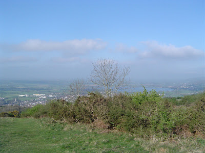
Looks like half a house at Lewtrenchard


I stopped for lunch (a cold pastie) in some woodland at Hedge Cross and where some sun came through I laid out the tarp to dry, thereby probably lightening my load by several ounces.

From here for the next few miles, the trail was close to the edge of Dartmoor, getting gradually closer.


About a mile beyond a hamlet called Watergate (the usual barking dogs trying to impress their owner), I switched to the West Devon Way. At Sourton I was nearly tempted into the village hall where the church was doing a roaring trade in cream teass but I wanted to get on (oh it was so tempting) and the climb up on to Dartmoor awaited.


Here I was on territory that I knew from previous visits and so I set a compass bearing for the village of Meldon. It was an easy elevated walk which then went under the A30 and then down to the campsite behind the Betty Cottles Inn, used regularly by Backpackers Club members for weekend meetings.

In the car park were three beautiful Austin 7's, part of a contingent travelling from Lowestoft to Land's End (furthest east to furthest west).